Huelkail geodata
Huelkail (East Nusa Tenggara) is a seat of a fourth-order administrative division; located in Indonesia in Asia/Makassar (GMT+8) time zone. In our database, there are 407 cities with bigger population. Compared to other cities in Indonesia, 94% of cities are located further ↑North; 94.4% of cities are located further ←West and 89.6% of cities have lower elevation than Huelkail. Note1


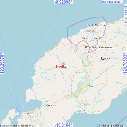
Huelkail GPS coordinates[2]
9° 37' 26.04" South, 124° 0' 6.84" East
| Map corner | latitude | longitude |
|---|---|---|
| Upper-left | -8.92998°, | 123.29878° |
| Center: | -9.6239°, | 124.0019° |
| Lower-right: | -10.3164°, | 124.70503° |
| Map W x H: | 154.2×154.2 km | = 95.8×95.8mi |
| max Lat: | 5.88969° ⇑94% North |
| Huelkail: | -9.6239° |
| min Lat: | ⇓6% South -10.934° |
| min Long | Huelkail | max Long |
| 95.1345° | 124.0019° | 140.9419° |
| W 94.4%⇐ | ⇒5.6% E |
Elevation
Elevation of Huelkail is 627 m = 2057 ft, and this is 397.3 m = 1303 ft above average elevation for this country.
| Max E: |
3185 m = 10449 ft | 10.4% |
| Huelkail | 627 m 2057 ft | |
| Avg. | 229.7 m = 754 ft | |
Min E: |
-1 m = -3 ft | 89.6% |
See also: Indonesia elevation on elevation.city.
Geographical zone
Huelkail is located in South Torrid zone (between Equator and Tropic of Capricorn). Distance of Equator is 1070.1 km =664.9 mi to North.| Distance of | km | miles | from Huelkail |
|---|---|---|---|
| Equator | 1070.1 | 664.9 | to North |
| Tropic Capricorn | 1535.8 | 954.3 | to South |
| Antarctic Circle | 6331.1 | 3934 | to South |
| South Pole | 8937 | 5553.2 | to South |


Nearby cities:
15 places around Huelkail: (largest is in red/bold)
• Anoek
10.5 km =6.5 mi,  187°
187°
• Binafun
5.6 km =3.5 mi,  138°
138°
• Bitobe
1.9 km =1.2 mi,  237°
237°
• Fatumetan
14.1 km =8.8 mi,  202°
202°
• Fatupael
10.4 km =6.5 mi,  209°
209°
• Leloboko
11.7 km =7.3 mi,  223°
223°
• Leloboko
21.5 km =13.4 mi,  108°
108°
• Lelogama
11.1 km =6.9 mi, 208°
• Liliana
17.2 km =10.7 mi,  118°
118°
• Nefokoko
20 km =12.4 mi, 124°
• Nifu
17.1 km =10.6 mi, 107°
• Nunsena
21.2 km =13.2 mi,  59°
59°
• Oelbanu
14.5 km =9 mi,  231°
231°
• Oenenas
5.9 km =3.7 mi,  169°
169°
• Oepula
19.5 km =12.1 mi,  175°
175°
Sources, notices
• [Note1] Compared only with cities in Indonesia existing in our database
• [Src1] Map data: © OpenStreetMap contributors (CC-BY-SA)
• [Src2] Other city data from geonames.org with taken over terms of usage.
• [Src3] Geographical zone / Annual Mean Temperature by Robert A. Rohde @ Wikipedia
