Moru geodata
Moru (East Nusa Tenggara) is a seat of a third-order administrative division; located in Indonesia in Asia/Makassar (GMT+8) time zone. In our database, there are 407 cities with bigger population. Compared to other cities in Indonesia, 74.6% of cities are located further ↑North; 96.6% of cities are located further ←West and 78.9% of cities have higher elevation than Moru. Note1


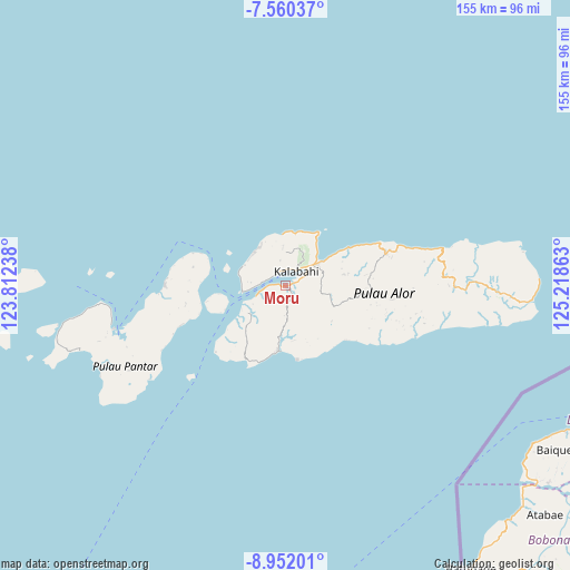
Moru GPS coordinates[2]
8° 15' 24.48" South, 124° 30' 55.8" East
| Map corner | latitude | longitude |
|---|---|---|
| Upper-left | -7.56037°, | 123.81238° |
| Center: | -8.2568°, | 124.5155° |
| Lower-right: | -8.95201°, | 125.21863° |
| Map W x H: | 154.7×154.7 km | = 96.1×96.1mi |
| max Lat: | 5.88969° ⇑74.6% North |
| Moru: | -8.2568° |
| min Lat: | ⇓25.4% South -10.934° |
| min Long | Moru | max Long |
| 95.1345° | 124.5155° | 140.9419° |
| W 96.6%⇐ | ⇒3.4% E |
Elevation
Elevation of Moru is 20 m = 66 ft, and this is 209.7 m = 688 ft below average elevation for this country.
| Max E: |
3185 m = 10449 ft | 78.9% |
| Avg. | 229.7 m = 754 ft | |
| Moru | 20 m = 66 ft | |
Min E: |
-1 m = -3 ft | 21.1% |
See also: Indonesia elevation on elevation.city.
Geographical zone
Moru is located in South Torrid zone (between Equator and Tropic of Capricorn). Distance of Equator is 918.1 km =570.5 mi to North.| Distance of | km | miles | from Moru |
|---|---|---|---|
| Equator | 918.1 | 570.5 | to North |
| Tropic Capricorn | 1687.8 | 1048.7 | to South |
| Antarctic Circle | 6483.1 | 4028.4 | to South |
| South Pole | 9089 | 5647.6 | to South |


Nearby cities:
15 places around Moru: (largest is in red/bold)
• Batutanata
4.8 km =3 mi,  13°
13°
• Binongko
4.3 km =2.7 mi,  356°
356°
• Doibang
6.9 km =4.3 mi,  347°
347°
• Dulolong
7.5 km =4.7 mi,  271°
271°
• Fa’aming
7.6 km =4.7 mi,  257°
257°
• Jembayan Hitam
5 km =3.1 mi,  37°
37°
• Kalabahi
5.7 km =3.5 mi, 35°
• Kampungraja
4.5 km =2.8 mi,  2°
2°
• Kenarilang
4.2 km =2.6 mi,  339°
339°
• Kikilai
1.2 km =0.7 mi,  137°
137°
• Lewolang
9.7 km =6 mi, 264°
• Maiwal
7.5 km =4.7 mi,  177°
177°
• Tongbang
5.5 km =3.4 mi,  28°
28°
• Watatuku
7 km =4.3 mi, 44°
• Welai
5.5 km =3.4 mi,  64°
64°
Sources, notices
• [Note1] Compared only with cities in Indonesia existing in our database
• [Src1] Map data: © OpenStreetMap contributors (CC-BY-SA)
• [Src2] Other city data from geonames.org with taken over terms of usage.
• [Src3] Geographical zone / Annual Mean Temperature by Robert A. Rohde @ Wikipedia
