Bedalewun geodata
Bedalewun (East Nusa Tenggara) is a seat of a fourth-order administrative division; located in Indonesia in Asia/Makassar (GMT+8) time zone. In our database, there are 407 cities with bigger population. Compared to other cities in Indonesia, 71% of cities are located further ↑North; 89.4% of cities are located further ←West and 63.2% of cities have higher elevation than Bedalewun. Note1


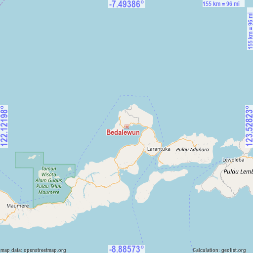
Bedalewun GPS coordinates[2]
8° 11' 25.44" South, 122° 49' 30.36" East
| Map corner | latitude | longitude |
|---|---|---|
| Upper-left | -7.49386°, | 122.12198° |
| Center: | -8.1904°, | 122.8251° |
| Lower-right: | -8.88573°, | 123.52823° |
| Map W x H: | 154.8×154.8 km | = 96.2×96.2mi |
| max Lat: | 5.88969° ⇑71% North |
| Bedalewun: | -8.1904° |
| min Lat: | ⇓29% South -10.934° |
| min Long | Bedalewun | max Long |
| 95.1345° | 122.8251° | 140.9419° |
| W 89.4%⇐ | ⇒10.6% E |
Elevation
Elevation of Bedalewun is 48 m = 157 ft, and this is 181.7 m = 596 ft below average elevation for this country.
| Max E: |
3185 m = 10449 ft | 63.2% |
| Avg. | 229.7 m = 754 ft | |
| Bedalewun | 48 m = 157 ft | |
Min E: |
-1 m = -3 ft | 36.8% |
See also: Indonesia elevation on elevation.city.
Geographical zone
Bedalewun is located in South Torrid zone (between Equator and Tropic of Capricorn). Distance of Equator is 910.7 km =565.9 mi to North.| Distance of | km | miles | from Bedalewun |
|---|---|---|---|
| Equator | 910.7 | 565.9 | to North |
| Tropic Capricorn | 1695.2 | 1053.3 | to South |
| Antarctic Circle | 6490.5 | 4033 | to South |
| South Pole | 9096.4 | 5652.2 | to South |


Nearby cities:
15 places around Bedalewun: (largest is in red/bold)
• Basira Satu
12.8 km =8 mi,  13°
13°
• Belogili
11 km =6.8 mi,  101°
101°
• Ebak
3.6 km =2.2 mi,  50°
50°
• Kawaliwu
12 km =7.5 mi,  139°
139°
• Koten
10.2 km =6.3 mi, 5°
• Laka
16.3 km =10.1 mi,  78°
78°
• Lamatou
15.5 km =9.6 mi,  133°
133°
• Lewoluo
14.6 km =9.1 mi,  195°
195°
• Lewotola
15.3 km =9.5 mi, 137°
• Riangkoli
11.6 km =7.2 mi,  88°
88°
• Riangkroko
5.6 km =3.5 mi,  315°
315°
• Riangpedang
12.6 km =7.8 mi,  151°
151°
• Riangpuho
2.3 km =1.4 mi,  250°
250°
• Turubeang
7.2 km =4.5 mi,  326°
326°
• Waiklibang
7.9 km =4.9 mi, 77°
Sources, notices
• [Note1] Compared only with cities in Indonesia existing in our database
• [Src1] Map data: © OpenStreetMap contributors (CC-BY-SA)
• [Src2] Other city data from geonames.org with taken over terms of usage.
• [Src3] Geographical zone / Annual Mean Temperature by Robert A. Rohde @ Wikipedia
