Babakandesa geodata
Babakandesa (West Java) is a seat of a fourth-order administrative division; located in Indonesia in Asia/Jakarta (GMT+7) time zone. In our database, there are 407 cities with bigger population. Compared to other cities in Indonesia, 62.7% of cities are located further ↓South; 80.7% of cities are located further →East and 87.2% of cities have lower elevation than Babakandesa. Note1


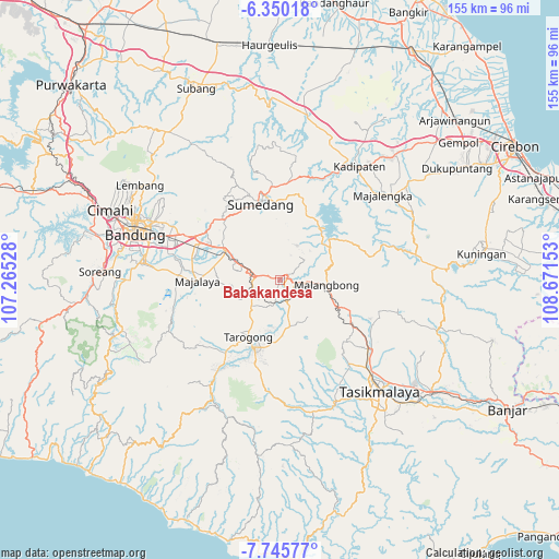
Babakandesa GPS coordinates[2]
7° 2' 54.6" South, 107° 58' 6.24" East
| Map corner | latitude | longitude |
|---|---|---|
| Upper-left | -6.35018°, | 107.26528° |
| Center: | -7.0485°, | 107.9684° |
| Lower-right: | -7.74577°, | 108.67153° |
| Map W x H: | 155.2×155.2 km | = 96.4×96.4mi |
| max Lat: | 5.88969° ⇑37.3% North |
| Babakandesa: | -7.0485° |
| min Lat: | ⇓62.7% South -10.934° |
| min Long | Babakandesa | max Long |
| 95.1345° | 107.9684° | 140.9419° |
| W 19.3%⇐ | ⇒80.7% E |
Elevation
Elevation of Babakandesa is 561 m = 1841 ft, and this is 331.3 m = 1087 ft above average elevation for this country.
| Max E: |
3185 m = 10449 ft | 12.8% |
| Babakandesa | 561 m 1841 ft | |
| Avg. | 229.7 m = 754 ft | |
Min E: |
-1 m = -3 ft | 87.2% |
See also: Indonesia elevation on elevation.city.
Geographical zone
Babakandesa is located in South Torrid zone (between Equator and Tropic of Capricorn). Distance of Equator is 783.7 km =487 mi to North.| Distance of | km | miles | from Babakandesa |
|---|---|---|---|
| Equator | 783.7 | 487 | to North |
| Tropic Capricorn | 1822.2 | 1132.3 | to South |
| Antarctic Circle | 6617.5 | 4111.9 | to South |
| South Pole | 9223.3 | 5731.1 | to South |


Nearby cities:
15 places around Babakandesa: (largest is in red/bold)
• Bakom
3.7 km =2.3 mi,  60°
60°
• Baluburlimbangan
2.1 km =1.3 mi,  48°
48°
• Bunisari
2.8 km =1.7 mi,  196°
196°
• Burujul
1.5 km =0.9 mi,  35°
35°
• Cigagade
1.5 km =0.9 mi,  295°
295°
• Cigaluh
3.3 km =2.1 mi,  97°
97°
• Cilolongokan
1.2 km =0.7 mi,  14°
14°
• Gempol
3.4 km =2.1 mi,  67°
67°
• Ikar
3.2 km =2 mi, 10°
• Kudang
2.4 km =1.5 mi, 45°
• Pasantrentengah
3.1 km =1.9 mi,  181°
181°
• Saradan
1.6 km =1 mi,  130°
130°
• Situbatu
3.3 km =2.1 mi, 201°
• Sukasari
2.3 km =1.4 mi,  192°
192°
• Tegallame
3.6 km =2.2 mi,  288°
288°
Sources, notices
• [Note1] Compared only with cities in Indonesia existing in our database
• [Src1] Map data: © OpenStreetMap contributors (CC-BY-SA)
• [Src2] Other city data from geonames.org with taken over terms of usage.
• [Src3] Geographical zone / Annual Mean Temperature by Robert A. Rohde @ Wikipedia
