Gondang geodata
Gondang (East Java) is a seat of a third-order administrative division; located in Indonesia in Asia/Jakarta (GMT+7) time zone. In our database, there are 407 cities with bigger population. Compared to other cities in Indonesia, 63.2% of cities are located further ↑North; 55.3% of cities are located further →East and 54.8% of cities have lower elevation than Gondang. Note1


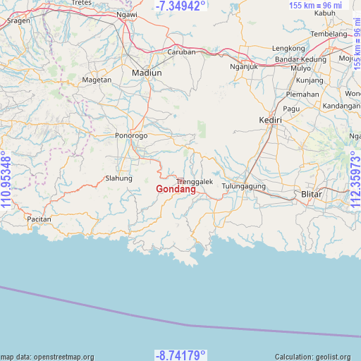
Gondang GPS coordinates[2]
8° 2' 46.32" South, 111° 39' 23.76" East
| Map corner | latitude | longitude |
|---|---|---|
| Upper-left | -7.34942°, | 110.95348° |
| Center: | -8.0462°, | 111.6566° |
| Lower-right: | -8.74179°, | 112.35973° |
| Map W x H: | 154.8×154.8 km | = 96.2×96.2mi |
| max Lat: | 5.88969° ⇑63.2% North |
| Gondang: | -8.0462° |
| min Lat: | ⇓36.8% South -10.934° |
| min Long | Gondang | max Long |
| 95.1345° | 111.6566° | 140.9419° |
| W 44.7%⇐ | ⇒55.3% E |
Elevation
Elevation of Gondang is 124 m = 407 ft, and this is 105.7 m = 347 ft below average elevation for this country.
| Max E: |
3185 m = 10449 ft | 45.2% |
| Avg. | 229.7 m = 754 ft | |
| Gondang | 124 m = 407 ft | |
Min E: |
-1 m = -3 ft | 54.8% |
See also: Indonesia elevation on elevation.city.
Geographical zone
Gondang is located in South Torrid zone (between Equator and Tropic of Capricorn). Distance of Equator is 894.7 km =555.9 mi to North.| Distance of | km | miles | from Gondang |
|---|---|---|---|
| Equator | 894.7 | 555.9 | to North |
| Tropic Capricorn | 1711.3 | 1063.4 | to South |
| Antarctic Circle | 6506.5 | 4043 | to South |
| South Pole | 9112.4 | 5662.2 | to South |


Nearby cities:
15 places around Gondang: (largest is in red/bold)
• Banarankrajan
1.5 km =0.9 mi,  68°
68°
• Banjar
4.3 km =2.7 mi,  146°
146°
• Jambu
2.5 km =1.6 mi,  303°
303°
• Kebon
0.4 km =0.2 mi,  328°
328°
• Krajan Kerjo
1.8 km =1.1 mi, 154°
• Krajan Winong
2.1 km =1.3 mi, 327°
• Ngentrong
2.6 km =1.6 mi,  83°
83°
• Nglongsor
0.6 km =0.4 mi,  99°
99°
• Prambonkrajan
2.7 km =1.7 mi,  30°
30°
• Rejosari
3.4 km =2.1 mi,  144°
144°
• Sukorejokrajan
1.5 km =0.9 mi,  293°
293°
• Sumberkrajan
3.5 km =2.2 mi, 97°
• Tegarenkrajan
2.8 km =1.7 mi, 330°
• Tugu
3.2 km =2 mi,  313°
313°
• Tumpuk
1.4 km =0.9 mi,  227°
227°
Sources, notices
• [Note1] Compared only with cities in Indonesia existing in our database
• [Src1] Map data: © OpenStreetMap contributors (CC-BY-SA)
• [Src2] Other city data from geonames.org with taken over terms of usage.
• [Src3] Geographical zone / Annual Mean Temperature by Robert A. Rohde @ Wikipedia
