Sindangheula geodata
Sindangheula (Central Java) is a seat of a fourth-order administrative division; located in Indonesia in Asia/Jakarta (GMT+7) time zone. In our database, there are 407 cities with bigger population. Compared to other cities in Indonesia, 60.8% of cities are located further ↓South; 67.6% of cities are located further →East and 53.7% of cities have lower elevation than Sindangheula. Note1


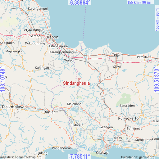
Sindangheula GPS coordinates[2]
7° 5' 16.44" South, 108° 48' 38.16" East
| Map corner | latitude | longitude |
|---|---|---|
| Upper-left | -6.38964°, | 108.10748° |
| Center: | -7.0879°, | 108.8106° |
| Lower-right: | -7.78511°, | 109.51373° |
| Map W x H: | 155.2×155.2 km | = 96.4×96.4mi |
| max Lat: | 5.88969° ⇑39.2% North |
| Sindangheula: | -7.0879° |
| min Lat: | ⇓60.8% South -10.934° |
| min Long | Sindangheula | max Long |
| 95.1345° | 108.8106° | 140.9419° |
| W 32.4%⇐ | ⇒67.6% E |
Elevation
Elevation of Sindangheula is 118 m = 387 ft, and this is 111.7 m = 366 ft below average elevation for this country.
| Max E: |
3185 m = 10449 ft | 46.3% |
| Avg. | 229.7 m = 754 ft | |
| Sindangheula | 118 m = 387 ft | |
Min E: |
-1 m = -3 ft | 53.7% |
See also: Indonesia elevation on elevation.city.
Geographical zone
Sindangheula is located in South Torrid zone (between Equator and Tropic of Capricorn). Distance of Equator is 788.1 km =489.7 mi to North.| Distance of | km | miles | from Sindangheula |
|---|---|---|---|
| Equator | 788.1 | 489.7 | to North |
| Tropic Capricorn | 1817.8 | 1129.5 | to South |
| Antarctic Circle | 6613.1 | 4109.2 | to South |
| South Pole | 9219 | 5728.4 | to South |


Nearby cities:
15 places around Sindangheula: (largest is in red/bold)
• Bandungsari
1.6 km =1 mi,  42°
42°
• Bentar
7 km =4.3 mi,  180°
180°
• Blandongan
3 km =1.9 mi,  91°
91°
• Cibingbin
6.1 km =3.8 mi,  299°
299°
• Cipanjang
2.6 km =1.6 mi,  2°
2°
• Cipondok
5.9 km =3.7 mi,  276°
276°
• Cisitu
6.1 km =3.8 mi,  192°
192°
• Cogreg
6.7 km =4.2 mi, 188°
• Kandayakan Satu
6.3 km =3.9 mi,  209°
209°
• Kertasari
3 km =1.9 mi, 43°
• Kliwon Cibingbin
6.6 km =4.1 mi, 300°
• Melahayu
7.1 km =4.4 mi,  14°
14°
• Pamedaran
6.4 km =4 mi,  69°
69°
• Penanggapan
3.7 km =2.3 mi,  317°
317°
• Sindangjawa
6.9 km =4.3 mi,  291°
291°
Sources, notices
• [Note1] Compared only with cities in Indonesia existing in our database
• [Src1] Map data: © OpenStreetMap contributors (CC-BY-SA)
• [Src2] Other city data from geonames.org with taken over terms of usage.
• [Src3] Geographical zone / Annual Mean Temperature by Robert A. Rohde @ Wikipedia
