Melahayu geodata
Melahayu (Central Java) is a seat of a fourth-order administrative division; located in Indonesia in Asia/Jakarta (GMT+7) time zone. In our database, there are 407 cities with bigger population. Compared to other cities in Indonesia, 64.2% of cities are located further ↓South; 67.5% of cities are located further →East and 66.8% of cities have higher elevation than Melahayu. Note1


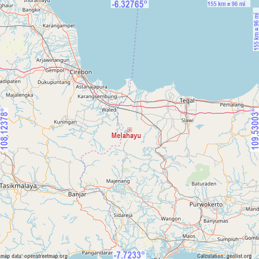
Melahayu GPS coordinates[2]
7° 1' 33.6" South, 108° 49' 36.84" East
| Map corner | latitude | longitude |
|---|---|---|
| Upper-left | -6.32765°, | 108.12378° |
| Center: | -7.026°, | 108.8269° |
| Lower-right: | -7.7233°, | 109.53003° |
| Map W x H: | 155.2×155.2 km | = 96.4×96.4mi |
| max Lat: | 5.88969° ⇑35.8% North |
| Melahayu: | -7.026° |
| min Lat: | ⇓64.2% South -10.934° |
| min Long | Melahayu | max Long |
| 95.1345° | 108.8269° | 140.9419° |
| W 32.5%⇐ | ⇒67.5% E |
Elevation
Elevation of Melahayu is 38 m = 125 ft, and this is 191.7 m = 629 ft below average elevation for this country.
| Max E: |
3185 m = 10449 ft | 66.8% |
| Avg. | 229.7 m = 754 ft | |
| Melahayu | 38 m = 125 ft | |
Min E: |
-1 m = -3 ft | 33.2% |
See also: Indonesia elevation on elevation.city.
Geographical zone
Melahayu is located in South Torrid zone (between Equator and Tropic of Capricorn). Distance of Equator is 781.2 km =485.4 mi to North.| Distance of | km | miles | from Melahayu |
|---|---|---|---|
| Equator | 781.2 | 485.4 | to North |
| Tropic Capricorn | 1824.7 | 1133.8 | to South |
| Antarctic Circle | 6620 | 4113.5 | to South |
| South Pole | 9225.8 | 5732.6 | to South |


Nearby cities:
15 places around Melahayu: (largest is in red/bold)
• Bandungsari
5.7 km =3.5 mi,  187°
187°
• Bantarpanjang
7 km =4.3 mi,  288°
288°
• Blandongan
7.1 km =4.4 mi,  170°
170°
• Cibingbin
8.2 km =5.1 mi,  241°
241°
• Cipanjang
4.6 km =2.9 mi,  201°
201°
• Cisaat
8.8 km =5.5 mi,  263°
263°
• Citenjo
8 km =5 mi, 255°
• Dukuhbadag
7.8 km =4.8 mi,  270°
270°
• Dukuhkopi
1.8 km =1.1 mi,  41°
41°
• Kertasari
4.7 km =2.9 mi,  177°
177°
• Kliwon Cibingbin
8.3 km =5.2 mi, 244°
• Pamedaran
6.3 km =3.9 mi,  138°
138°
• Penanggapan
6 km =3.7 mi,  226°
226°
• Sindangheula
7.1 km =4.4 mi, 194°
• Sukasari
9 km =5.6 mi,  248°
248°
Sources, notices
• [Note1] Compared only with cities in Indonesia existing in our database
• [Src1] Map data: © OpenStreetMap contributors (CC-BY-SA)
• [Src2] Other city data from geonames.org with taken over terms of usage.
• [Src3] Geographical zone / Annual Mean Temperature by Robert A. Rohde @ Wikipedia
