Sekapuk geodata
Sekapuk is a seat of a fourth-order administrative division; located in Indonesia in Asia/Jakarta (GMT+7) time zone. In our database, there are 407 cities with bigger population. Compared to other cities in Indonesia, 69.4% of cities are located further ↓South; 55.1% of cities are located further ←West and 66.4% of cities have higher elevation than Sekapuk. Note1


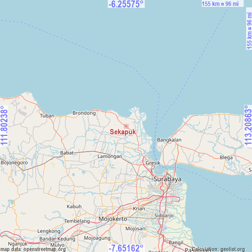
Sekapuk GPS coordinates[2]
6° 57' 15.12" South, 112° 30' 19.8" East
| Map corner | latitude | longitude |
|---|---|---|
| Upper-left | -6.25575°, | 111.80238° |
| Center: | -6.9542°, | 112.5055° |
| Lower-right: | -7.65162°, | 113.20863° |
| Map W x H: | 155.2×155.2 km | = 96.4×96.4mi |
| max Lat: | 5.88969° ⇑30.6% North |
| Sekapuk: | -6.9542° |
| min Lat: | ⇓69.4% South -10.934° |
| min Long | Sekapuk | max Long |
| 95.1345° | 112.5055° | 140.9419° |
| W 55.1%⇐ | ⇒44.9% E |
Elevation
Elevation of Sekapuk is 39 m = 128 ft, and this is 190.7 m = 626 ft below average elevation for this country.
| Max E: |
3185 m = 10449 ft | 66.4% |
| Avg. | 229.7 m = 754 ft | |
| Sekapuk | 39 m = 128 ft | |
Min E: |
-1 m = -3 ft | 33.6% |
See also: Indonesia elevation on elevation.city.
Geographical zone
Sekapuk is located in South Torrid zone (between Equator and Tropic of Capricorn). Distance of Equator is 773.2 km =480.4 mi to North.| Distance of | km | miles | from Sekapuk |
|---|---|---|---|
| Equator | 773.2 | 480.4 | to North |
| Tropic Capricorn | 1832.7 | 1138.8 | to South |
| Antarctic Circle | 6627.9 | 4118.4 | to South |
| South Pole | 9233.8 | 5737.6 | to South |


Nearby cities:
15 places around Sekapuk: (largest is in red/bold)
• Bolo
2.2 km =1.4 mi,  114°
114°
• Canga’an
3.6 km =2.2 mi,  0°
0°
• Doudo
0.8 km =0.5 mi,  251°
251°
• Gedangan
2 km =1.2 mi,  209°
209°
• Gosari
1.7 km =1.1 mi,  14°
14°
• Kebonagung
3.2 km =2 mi,  68°
68°
• Kertosonopilang
3.9 km =2.4 mi,  154°
154°
• Lasem
3.9 km =2.4 mi,  176°
176°
• Petung
3.7 km =2.3 mi,  236°
236°
• Sambipondok
2.9 km =1.8 mi,  132°
132°
• Sambogunung
3.9 km =2.4 mi,  192°
192°
• Saniwonorejo
3.7 km =2.3 mi, 205°
• Sukorejo
3.2 km =2 mi, 191°
• Wadeng
1.6 km =1 mi, 145°
• Wotan
2.2 km =1.4 mi, 254°
Sources, notices
• [Note1] Compared only with cities in Indonesia existing in our database
• [Src1] Map data: © OpenStreetMap contributors (CC-BY-SA)
• [Src2] Other city data from geonames.org with taken over terms of usage.
• [Src3] Geographical zone / Annual Mean Temperature by Robert A. Rohde @ Wikipedia
