Gedangan geodata
Gedangan (East Java) is a seat of a fourth-order administrative division; located in Indonesia in Asia/Jakarta (GMT+7) time zone. In our database, there are 407 cities with bigger population. Compared to other cities in Indonesia, 68.4% of cities are located further ↓South; 54.9% of cities are located further ←West and 77.1% of cities have higher elevation than Gedangan. Note1


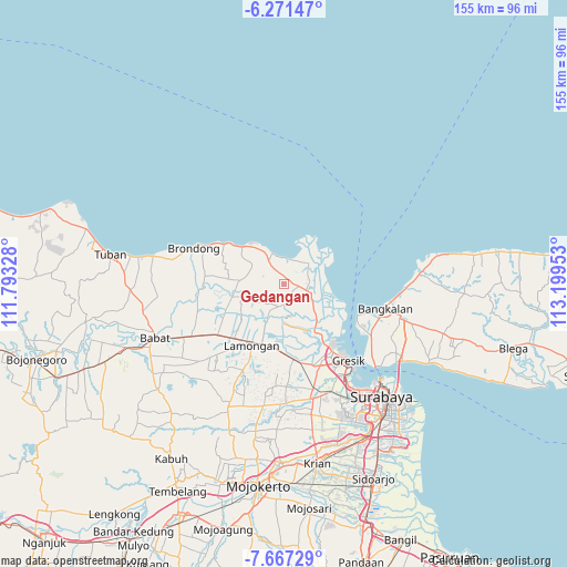
Gedangan GPS coordinates[2]
6° 58' 11.64" South, 112° 29' 47.04" East
| Map corner | latitude | longitude |
|---|---|---|
| Upper-left | -6.27147°, | 111.79328° |
| Center: | -6.9699°, | 112.4964° |
| Lower-right: | -7.66729°, | 113.19953° |
| Map W x H: | 155.2×155.2 km | = 96.4×96.4mi |
| max Lat: | 5.88969° ⇑31.6% North |
| Gedangan: | -6.9699° |
| min Lat: | ⇓68.4% South -10.934° |
| min Long | Gedangan | max Long |
| 95.1345° | 112.4964° | 140.9419° |
| W 54.9%⇐ | ⇒45.1% E |
Elevation
Elevation of Gedangan is 22 m = 72 ft, and this is 207.7 m = 681 ft below average elevation for this country.
| Max E: |
3185 m = 10449 ft | 77.1% |
| Avg. | 229.7 m = 754 ft | |
| Gedangan | 22 m = 72 ft | |
Min E: |
-1 m = -3 ft | 22.9% |
See also: Indonesia elevation on elevation.city.
Geographical zone
Gedangan is located in South Torrid zone (between Equator and Tropic of Capricorn). Distance of Equator is 775 km =481.6 mi to North.| Distance of | km | miles | from Gedangan |
|---|---|---|---|
| Equator | 775 | 481.6 | to North |
| Tropic Capricorn | 1830.9 | 1137.7 | to South |
| Antarctic Circle | 6626.2 | 4117.3 | to South |
| South Pole | 9232.1 | 5736.6 | to South |


Nearby cities:
15 places around Gedangan: (largest is in red/bold)
• Babakbawo
2.3 km =1.4 mi,  206°
206°
• Bolo
3.1 km =1.9 mi,  73°
73°
• Doudo
1.5 km =0.9 mi,  10°
10°
• Imaan
3 km =1.9 mi,  236°
236°
• Kertosonopilang
3.2 km =2 mi,  123°
123°
• Lasem
2.4 km =1.5 mi,  149°
149°
• Mojopetung
3.4 km =2.1 mi,  249°
249°
• Petung
2.1 km =1.3 mi,  262°
262°
• Sambipondok
3.2 km =2 mi,  94°
94°
• Sambogunung
2.1 km =1.3 mi,  175°
175°
• Saniwonorejo
1.7 km =1.1 mi,  200°
200°
• Sekapuk
2 km =1.2 mi,  29°
29°
• Sukorejo
1.4 km =0.9 mi,  164°
164°
• Wadeng
2 km =1.2 mi,  78°
78°
• Wotan
1.6 km =1 mi,  316°
316°
Sources, notices
• [Note1] Compared only with cities in Indonesia existing in our database
• [Src1] Map data: © OpenStreetMap contributors (CC-BY-SA)
• [Src2] Other city data from geonames.org with taken over terms of usage.
• [Src3] Geographical zone / Annual Mean Temperature by Robert A. Rohde @ Wikipedia
