Negara geodata
Negara (Bali) is a populated place; located in Indonesia in Asia/Makassar (GMT+8) time zone. With population of 33,191 people, there are 301 cities with bigger population in this country. Compared to other cities in Indonesia, 79% of cities are located further ↑North; 69.9% of cities are located further ←West and 87.7% of cities have higher elevation than Negara. Note1


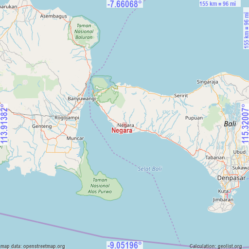
Negara GPS coordinates[2]
8° 21' 24.984" South, 114° 37' 0.984" East
| Map corner | latitude | longitude |
|---|---|---|
| Upper-left | -7.66068°, | 113.91382° |
| Center: | -8.35694°, | 114.61694° |
| Lower-right: | -9.05196°, | 115.32007° |
| Map W x H: | 154.7×154.7 km | = 96.1×96.1mi |
| max Lat: | 5.88969° ⇑79% North |
| Negara: | -8.35694° |
| min Lat: | ⇓21% South -10.934° |
| min Long | Negara | max Long |
| 95.1345° | 114.61694° | 140.9419° |
| W 69.9%⇐ | ⇒30.1% E |
Elevation
Elevation of Negara is 12 m = 39 ft, and this is 217.7 m = 714 ft below average elevation for this country.
| Max E: |
3185 m = 10449 ft | 87.7% |
| Avg. | 229.7 m = 754 ft | |
| Negara | 12 m = 39 ft | |
Min E: |
-1 m = -3 ft | 12.3% |
See also: Indonesia elevation on elevation.city.
Geographical zone
Negara is located in South Torrid zone (between Equator and Tropic of Capricorn). Distance of Equator is 929.2 km =577.4 mi to North.| Distance of | km | miles | from Negara |
|---|---|---|---|
| Equator | 929.2 | 577.4 | to North |
| Tropic Capricorn | 1676.7 | 1041.9 | to South |
| Antarctic Circle | 6472 | 4021.5 | to South |
| South Pole | 9077.9 | 5640.7 | to South |


Nearby cities:
15 places around Negara: (largest is in red/bold)
• Baler Baleagung
6.2 km =3.9 mi,  106°
106°
• Banjar Dauhmarga
7.2 km =4.5 mi,  122°
122°
• Banjar Delodsetra
22.6 km =14 mi,  101°
101°
• Banjar Mundukanggrek
14 km =8.7 mi, 99°
• Banjar Sebual
4.5 km =2.8 mi, 103°
• Banjar Tegakgede
17.9 km =11.1 mi, 103°
• Banjar Tengah
5.6 km =3.5 mi, 100°
• Banjar Yehsatang
20.8 km =12.9 mi, 101°
• Batuagung
2.9 km =1.8 mi, 95°
• Delod Pangkung
3.4 km =2.1 mi,  143°
143°
• Jembrana Subdistrict
6.5 km =4 mi,  315°
315°
• Loloan Timur
1.4 km =0.9 mi, 137°
• Munduk
6.9 km =4.3 mi, 101°
• Pamedilan
3 km =1.9 mi, 107°
• Satria
1.1 km =0.7 mi,  69°
69°
Sources, notices
• [Note1] Compared only with cities in Indonesia existing in our database
• [Src1] Map data: © OpenStreetMap contributors (CC-BY-SA)
• [Src2] Other city data from geonames.org with taken over terms of usage.
• [Src3] Geographical zone / Annual Mean Temperature by Robert A. Rohde @ Wikipedia
