Munduk geodata
Munduk (Bali) is a populated place; located in Indonesia in Asia/Makassar (GMT+8) time zone. With population of 6,200 people, there are 385 cities with bigger population in this country. Compared to other cities in Indonesia, 75.2% of cities are located further ↑North; 71.3% of cities are located further ←West and 98.7% of cities have lower elevation than Munduk. Note1


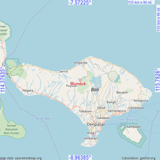
Munduk GPS coordinates[2]
8° 16' 7.176" South, 115° 4' 46.092" East
| Map corner | latitude | longitude |
|---|---|---|
| Upper-left | -7.57225°, | 114.37635° |
| Center: | -8.26866°, | 115.07947° |
| Lower-right: | -8.96385°, | 115.7826° |
| Map W x H: | 154.7×154.7 km | = 96.1×96.1mi |
| max Lat: | 5.88969° ⇑75.2% North |
| Munduk: | -8.26866° |
| min Lat: | ⇓24.8% South -10.934° |
| min Long | Munduk | max Long |
| 95.1345° | 115.07947° | 140.9419° |
| W 71.3%⇐ | ⇒28.7% E |
Elevation
Elevation of Munduk is 1163 m = 3816 ft, and this is 933.3 m = 3062 ft above average elevation for this country.
| Max E: |
3185 m = 10449 ft | 1.3% |
| Munduk | 1163 m 3816 ft | |
| Avg. | 229.7 m = 754 ft | |
Min E: |
-1 m = -3 ft | 98.7% |
See also: Indonesia elevation on elevation.city.
Geographical zone
Munduk is located in South Torrid zone (between Equator and Tropic of Capricorn). Distance of Equator is 919.4 km =571.3 mi to North.| Distance of | km | miles | from Munduk |
|---|---|---|---|
| Equator | 919.4 | 571.3 | to North |
| Tropic Capricorn | 1686.5 | 1047.9 | to South |
| Antarctic Circle | 6481.8 | 4027.6 | to South |
| South Pole | 9087.7 | 5646.8 | to South |


Nearby cities:
15 places around Munduk: (largest is in red/bold)
• Banjar Cempaga
9.2 km =5.7 mi,  304°
304°
• Banjar Dauhpura
9.7 km =6 mi,  320°
320°
• Banjar Kayuputih
10.4 km =6.5 mi,  336°
336°
• Banjar Pedawa
6.9 km =4.3 mi, 301°
• Banjar Selat
10.4 km =6.5 mi,  351°
351°
• Banjar Tamansari
8.9 km =5.5 mi,  286°
286°
• Banjarsari
10.6 km =6.6 mi,  284°
284°
• Bantiran
10.8 km =6.7 mi,  245°
245°
• Dajanpura
10.8 km =6.7 mi, 301°
• Kanginan
10.9 km =6.8 mi,  259°
259°
• Pelapuan
10 km =6.2 mi,  271°
271°
• Puspajati
9.6 km =6 mi, 276°
• Subuk
11.5 km =7.1 mi, 259°
• Taman
5 km =3.1 mi, 281°
• Tengah
5.3 km =3.3 mi, 277°
Sources, notices
• [Note1] Compared only with cities in Indonesia existing in our database
• [Src1] Map data: © OpenStreetMap contributors (CC-BY-SA)
• [Src2] Other city data from geonames.org with taken over terms of usage.
• [Src3] Geographical zone / Annual Mean Temperature by Robert A. Rohde @ Wikipedia
