Muaralabuh geodata
Muaralabuh (West Sumatra) is a seat of a third-order administrative division; located in Indonesia in Asia/Jakarta (GMT+7) time zone. In our database, there are 407 cities with bigger population. Compared to other cities in Indonesia, 93.5% of cities are located further ↓South; 96.5% of cities are located further →East and 80.5% of cities have lower elevation than Muaralabuh. Note1


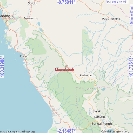
Muaralabuh GPS coordinates[2]
1° 27' 43.56" South, 101° 1' 22.8" East
| Map corner | latitude | longitude |
|---|---|---|
| Upper-left | -0.75911°, | 100.31988° |
| Center: | -1.4621°, | 101.023° |
| Lower-right: | -2.16487°, | 101.72613° |
| Map W x H: | 156.3×156.3 km | = 97.1×97.1mi |
| max Lat: | 5.88969° ⇑6.5% North |
| Muaralabuh: | -1.4621° |
| min Lat: | ⇓93.5% South -10.934° |
| min Long | Muaralabuh | max Long |
| 95.1345° | 101.023° | 140.9419° |
| W 3.5%⇐ | ⇒96.5% E |
Elevation
Elevation of Muaralabuh is 439 m = 1440 ft, and this is 209.3 m = 687 ft above average elevation for this country.
| Max E: |
3185 m = 10449 ft | 19.5% |
| Muaralabuh | 439 m 1440 ft | |
| Avg. | 229.7 m = 754 ft | |
Min E: |
-1 m = -3 ft | 80.5% |
See also: Indonesia elevation on elevation.city.
Geographical zone
Muaralabuh is located in South Torrid zone (between Equator and Tropic of Capricorn). Distance of Equator is 162.6 km =101 mi to North.| Distance of | km | miles | from Muaralabuh |
|---|---|---|---|
| Equator | 162.6 | 101 | to North |
| Tropic Capricorn | 2443.3 | 1518.2 | to South |
| Antarctic Circle | 7238.6 | 4497.9 | to South |
| South Pole | 9844.5 | 6117.1 | to South |


Nearby cities:
15 places around Muaralabuh: (largest is in red/bold)
• Alahanpanjang
50 km =31.1 mi,  329°
329°
• Arosuka
72.2 km =44.9 mi,  321°
321°
• Gunung Talang
75.9 km =47.2 mi, 324°
• Kambang
42.1 km =26.2 mi,  232°
232°
• Lubukgadang
28.7 km =17.8 mi,  104°
104°
• Mandarahan
42.9 km =26.7 mi,  210°
210°
• Padang Aro
27.7 km =17.2 mi,  105°
105°
• Painan
51.4 km =31.9 mi,  283°
283°
• Pasarbaru
59.6 km =37 mi,  287°
287°
• Pasarkuok
44.6 km =27.7 mi,  272°
272°
• Semurup
70.3 km =43.7 mi,  146°
146°
• Sirukam
70.3 km =43.7 mi,  335°
335°
• Siulak
64 km =39.8 mi, 147°
• Siulakderasmudik
54.5 km =33.9 mi,  155°
155°
• Surian
27.8 km =17.3 mi, 325°
Sources, notices
• [Note1] Compared only with cities in Indonesia existing in our database
• [Src1] Map data: © OpenStreetMap contributors (CC-BY-SA)
• [Src2] Other city data from geonames.org with taken over terms of usage.
• [Src3] Geographical zone / Annual Mean Temperature by Robert A. Rohde @ Wikipedia
