Muara Dua geodata
Muara Dua (South Sumatra) is a seat of a third-order administrative division; located in Indonesia in Asia/Jakarta (GMT+7) time zone. In our database, there are 407 cities with bigger population. Compared to other cities in Indonesia, 89% of cities are located further ↓South; 95.1% of cities are located further →East and 56.7% of cities have lower elevation than Muara Dua. Note1


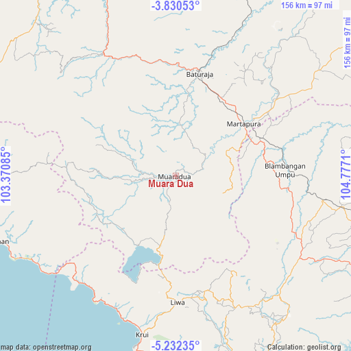
Muara Dua GPS coordinates[2]
4° 31' 54.408" South, 104° 4' 26.292" East
| Map corner | latitude | longitude |
|---|---|---|
| Upper-left | -3.83053°, | 103.37085° |
| Center: | -4.53178°, | 104.07397° |
| Lower-right: | -5.23235°, | 104.7771° |
| Map W x H: | 155.9×155.9 km | = 96.9×96.9mi |
| max Lat: | 5.88969° ⇑11% North |
| Muara Dua: | -4.53178° |
| min Lat: | ⇓89% South -10.934° |
| min Long | Muara Dua | max Long |
| 95.1345° | 104.07397° | 140.9419° |
| W 4.9%⇐ | ⇒95.1% E |
Elevation
Elevation of Muara Dua is 135 m = 443 ft, and this is 94.7 m = 311 ft below average elevation for this country.
| Max E: |
3185 m = 10449 ft | 43.3% |
| Avg. | 229.7 m = 754 ft | |
| Muara Dua | 135 m = 443 ft | |
Min E: |
-1 m = -3 ft | 56.7% |
See also: Indonesia elevation on elevation.city.
Geographical zone
Muara Dua is located in South Torrid zone (between Equator and Tropic of Capricorn). Distance of Equator is 503.9 km =313.1 mi to North.| Distance of | km | miles | from Muara Dua |
|---|---|---|---|
| Equator | 503.9 | 313.1 | to North |
| Tropic Capricorn | 2102 | 1306.1 | to South |
| Antarctic Circle | 6897.3 | 4285.8 | to South |
| South Pole | 9503.2 | 5905 | to South |


Nearby cities:
15 places around Muara Dua: (largest is in red/bold)
• Banding Agung
35 km =21.7 mi,  208°
208°
• Bara Datu
52.4 km =32.6 mi,  116°
116°
• Baturaja
46 km =28.6 mi,  12°
12°
• Blambangan Umpu
49.5 km =30.8 mi,  86°
86°
• Kasui
46.4 km =28.8 mi, 116°
• Kenali
52.8 km =32.8 mi,  165°
165°
• Kuripan
65.7 km =40.8 mi, 211°
• Kurungannyawa
54.3 km =33.7 mi,  52°
52°
• Liwa
56 km =34.8 mi,  179°
179°
• Martapura
38.4 km =23.9 mi, 51°
• Pasar Banjit
54.2 km =33.7 mi, 123°
• Pengandonan
57.4 km =35.7 mi,  337°
337°
• Pulauberingin
48.6 km =30.2 mi,  274°
274°
• Simpang
16 km =9.9 mi, 54°
• Umbulan Kapiak
60.6 km =37.7 mi, 123°
Sources, notices
• [Note1] Compared only with cities in Indonesia existing in our database
• [Src1] Map data: © OpenStreetMap contributors (CC-BY-SA)
• [Src2] Other city data from geonames.org with taken over terms of usage.
• [Src3] Geographical zone / Annual Mean Temperature by Robert A. Rohde @ Wikipedia
