Mander geodata
Mander (East Java) is a seat of a fourth-order administrative division; located in Indonesia in Asia/Jakarta (GMT+7) time zone. In our database, there are 407 cities with bigger population. Compared to other cities in Indonesia, 74.7% of cities are located further ↓South; 52.9% of cities are located further →East and 61.6% of cities have higher elevation than Mander. Note1


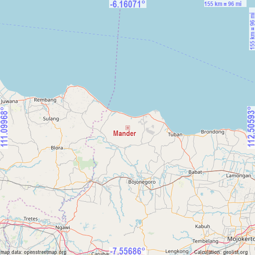
Mander GPS coordinates[2]
6° 51' 33.48" South, 111° 48' 10.08" East
| Map corner | latitude | longitude |
|---|---|---|
| Upper-left | -6.16071°, | 111.09968° |
| Center: | -6.8593°, | 111.8028° |
| Lower-right: | -7.55686°, | 112.50593° |
| Map W x H: | 155.2×155.2 km | = 96.4×96.4mi |
| max Lat: | 5.88969° ⇑25.3% North |
| Mander: | -6.8593° |
| min Lat: | ⇓74.7% South -10.934° |
| min Long | Mander | max Long |
| 95.1345° | 111.8028° | 140.9419° |
| W 47.1%⇐ | ⇒52.9% E |
Elevation
Elevation of Mander is 53 m = 174 ft, and this is 176.7 m = 580 ft below average elevation for this country.
| Max E: |
3185 m = 10449 ft | 61.6% |
| Avg. | 229.7 m = 754 ft | |
| Mander | 53 m = 174 ft | |
Min E: |
-1 m = -3 ft | 38.4% |
See also: Indonesia elevation on elevation.city.
Geographical zone
Mander is located in South Torrid zone (between Equator and Tropic of Capricorn). Distance of Equator is 762.7 km =473.9 mi to North.| Distance of | km | miles | from Mander |
|---|---|---|---|
| Equator | 762.7 | 473.9 | to North |
| Tropic Capricorn | 1843.2 | 1145.3 | to South |
| Antarctic Circle | 6638.5 | 4125 | to South |
| South Pole | 9244.4 | 5744.2 | to South |


Nearby cities:
15 places around Mander: (largest is in red/bold)
• Belik
3.4 km =2.1 mi,  16°
16°
• Cingklung
5.4 km =3.4 mi,  10°
10°
• Dikir
2.9 km =1.8 mi,  247°
247°
• Dukoh
4.9 km =3 mi,  28°
28°
• Gemulung
2.3 km =1.4 mi,  164°
164°
• Klutuk
6 km =3.7 mi,  41°
41°
• Mekarsari
4.3 km =2.7 mi,  105°
105°
• Mojoroto
5.9 km =3.7 mi,  334°
334°
• Ngulahan
2.9 km =1.8 mi,  227°
227°
• Pasatan
4.3 km =2.7 mi, 17°
• Plajan
2.1 km =1.3 mi,  292°
292°
• Simo
5.2 km =3.2 mi,  324°
324°
• Sriwing
4 km =2.5 mi,  340°
340°
• Sruki
5.8 km =3.6 mi, 8°
• Trantang
3.7 km =2.3 mi, 156°
Sources, notices
• [Note1] Compared only with cities in Indonesia existing in our database
• [Src1] Map data: © OpenStreetMap contributors (CC-BY-SA)
• [Src2] Other city data from geonames.org with taken over terms of usage.
• [Src3] Geographical zone / Annual Mean Temperature by Robert A. Rohde @ Wikipedia
