Gemulung geodata
Gemulung (East Java) is a seat of a fourth-order administrative division; located in Indonesia in Asia/Jakarta (GMT+7) time zone. In our database, there are 407 cities with bigger population. Compared to other cities in Indonesia, 73.9% of cities are located further ↓South; 52.9% of cities are located further →East and 53.7% of cities have higher elevation than Gemulung. Note1


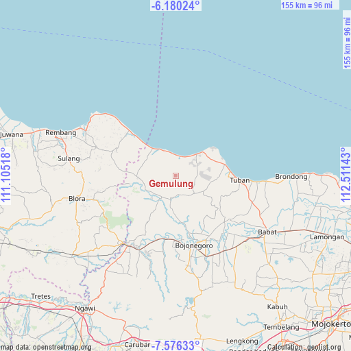
Gemulung GPS coordinates[2]
6° 52' 43.68" South, 111° 48' 29.88" East
| Map corner | latitude | longitude |
|---|---|---|
| Upper-left | -6.18024°, | 111.10518° |
| Center: | -6.8788°, | 111.8083° |
| Lower-right: | -7.57633°, | 112.51143° |
| Map W x H: | 155.2×155.2 km | = 96.4×96.4mi |
| max Lat: | 5.88969° ⇑26.1% North |
| Gemulung: | -6.8788° |
| min Lat: | ⇓73.9% South -10.934° |
| min Long | Gemulung | max Long |
| 95.1345° | 111.8083° | 140.9419° |
| W 47.1%⇐ | ⇒52.9% E |
Elevation
Elevation of Gemulung is 90 m = 295 ft, and this is 139.7 m = 458 ft below average elevation for this country.
| Max E: |
3185 m = 10449 ft | 53.7% |
| Avg. | 229.7 m = 754 ft | |
| Gemulung | 90 m = 295 ft | |
Min E: |
-1 m = -3 ft | 46.3% |
See also: Indonesia elevation on elevation.city.
Geographical zone
Gemulung is located in South Torrid zone (between Equator and Tropic of Capricorn). Distance of Equator is 764.9 km =475.3 mi to North.| Distance of | km | miles | from Gemulung |
|---|---|---|---|
| Equator | 764.9 | 475.3 | to North |
| Tropic Capricorn | 1841.1 | 1144 | to South |
| Antarctic Circle | 6636.3 | 4123.6 | to South |
| South Pole | 9242.2 | 5742.8 | to South |


Nearby cities:
15 places around Gemulung: (largest is in red/bold)
• Belik
5.5 km =3.4 mi,  3°
3°
• Dikir
3.5 km =2.2 mi,  287°
287°
• Dukoh
6.7 km =4.2 mi,  14°
14°
• Mander
2.3 km =1.4 mi,  344°
344°
• Mekarsari
3.7 km =2.3 mi,  73°
73°
• Ngluwuk
7.4 km =4.6 mi,  88°
88°
• Ngulahan
2.8 km =1.7 mi,  273°
273°
• Pasatan
6.3 km =3.9 mi, 6°
• Plajan
4 km =2.5 mi,  319°
319°
• Sidomulyo
5.8 km =3.6 mi, 88°
• Sidonganti
5 km =3.1 mi,  162°
162°
• Simo
7.4 km =4.6 mi,  330°
330°
• Sriwing
6.3 km =3.9 mi, 342°
• Tengger
6.3 km =3.9 mi,  134°
134°
• Trantang
1.5 km =0.9 mi,  145°
145°
Sources, notices
• [Note1] Compared only with cities in Indonesia existing in our database
• [Src1] Map data: © OpenStreetMap contributors (CC-BY-SA)
• [Src2] Other city data from geonames.org with taken over terms of usage.
• [Src3] Geographical zone / Annual Mean Temperature by Robert A. Rohde @ Wikipedia
