Lubuk Sikaping geodata
Lubuk Sikaping (West Sumatra) is a seat of a second-order administrative division; located in Indonesia in Asia/Jakarta (GMT+7) time zone. In our database, there are 407 cities with bigger population. Compared to other cities in Indonesia, 95.3% of cities are located further ↓South; 97.3% of cities are located further →East and 81.4% of cities have lower elevation than Lubuk Sikaping. Note1


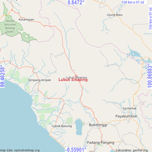
Lubuk Sikaping GPS coordinates[2]
0° 8' 38.796" North, 100° 9' 56.52" East
| Map corner | latitude | longitude |
|---|---|---|
| Upper-left | 0.8472°, | 99.46258° |
| Center: | 0.14411°, | 100.1657° |
| Lower-right: | -0.55901°, | 100.86883° |
| Map W x H: | 156.4×156.4 km | = 97.2×97.2mi |
| max Lat: | 5.88969° ⇑4.7% North |
| Lubuk Sikaping: | 0.14411° |
| min Lat: | ⇓95.3% South -10.934° |
| min Long | Lubuk Sikaping | max Long |
| 95.1345° | 100.1657° | 140.9419° |
| W 2.7%⇐ | ⇒97.3% E |
Elevation
Elevation of Lubuk Sikaping is 453 m = 1486 ft, and this is 223.3 m = 733 ft above average elevation for this country.
| Max E: |
3185 m = 10449 ft | 18.6% |
| Lubuk Sikaping | 453 m 1486 ft | |
| Avg. | 229.7 m = 754 ft | |
Min E: |
-1 m = -3 ft | 81.4% |
See also: Indonesia elevation on elevation.city.
Geographical zone
Lubuk Sikaping is located in North Torrid zone (between Equator and Tropic of Cancer). Distance of Equator is 16 km =9.9 mi to South.| Distance of | km | miles | from Lubuk Sikaping |
|---|---|---|---|
| North Pole | 9991 | 6208.1 | to North |
| Arctic Circle | 7385.2 | 4588.9 | to North |
| Tropic Cancer | 2589.9 | 1609.3 | to North |
| Equator | 16 | 9.9 | to South |


Nearby cities:
15 places around Lubuk Sikaping: (largest is in red/bold)
• Baso
57.1 km =35.5 mi,  145°
145°
• Bonjol
19.3 km =12 mi,  159°
159°
• Bukittinggi
55.3 km =34.4 mi, 155°
• Guguk
53.3 km =33.1 mi,  126°
126°
• Kotatua
58.6 km =36.4 mi, 158°
• Lubuk Basung
53.4 km =33.2 mi,  192°
192°
• Maninjau
49.9 km =31 mi,  172°
172°
• Matur
48.9 km =30.4 mi, 163°
• Muara Sipongi
50.2 km =31.2 mi,  340°
340°
• Palembaian
37.2 km =23.1 mi, 168°
• Panti
27.2 km =16.9 mi,  333°
333°
• Rokan
54.4 km =33.8 mi,  29°
29°
• Sarilamak
64.4 km =40 mi,  120°
120°
• Simpang Empat
38.4 km =23.9 mi,  262°
262°
• Talu
22.6 km =14 mi,  294°
294°
Sources, notices
• [Note1] Compared only with cities in Indonesia existing in our database
• [Src1] Map data: © OpenStreetMap contributors (CC-BY-SA)
• [Src2] Other city data from geonames.org with taken over terms of usage.
• [Src3] Geographical zone / Annual Mean Temperature by Robert A. Rohde @ Wikipedia
