Lebakkeusik geodata
Lebakkeusik (Banten) is a seat of a fourth-order administrative division; located in Indonesia in Asia/Jakarta (GMT+7) time zone. In our database, there are 407 cities with bigger population. Compared to other cities in Indonesia, 82.6% of cities are located further ↓South; 91.7% of cities are located further →East and 70.2% of cities have higher elevation than Lebakkeusik. Note1


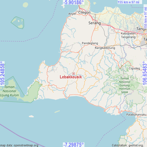
Lebakkeusik GPS coordinates[2]
6° 36' 2.88" South, 105° 57' 6.12" East
| Map corner | latitude | longitude |
|---|---|---|
| Upper-left | -5.90186°, | 105.24858° |
| Center: | -6.6008°, | 105.9517° |
| Lower-right: | -7.29875°, | 106.65483° |
| Map W x H: | 155.3×155.3 km | = 96.5×96.5mi |
| max Lat: | 5.88969° ⇑17.4% North |
| Lebakkeusik: | -6.6008° |
| min Lat: | ⇓82.6% South -10.934° |
| min Long | Lebakkeusik | max Long |
| 95.1345° | 105.9517° | 140.9419° |
| W 8.3%⇐ | ⇒91.7% E |
Elevation
Elevation of Lebakkeusik is 32 m = 105 ft, and this is 197.7 m = 649 ft below average elevation for this country.
| Max E: |
3185 m = 10449 ft | 70.2% |
| Avg. | 229.7 m = 754 ft | |
| Lebakkeusik | 32 m = 105 ft | |
Min E: |
-1 m = -3 ft | 29.8% |
See also: Indonesia elevation on elevation.city.
Geographical zone
Lebakkeusik is located in South Torrid zone (between Equator and Tropic of Capricorn). Distance of Equator is 733.9 km =456 mi to North.| Distance of | km | miles | from Lebakkeusik |
|---|---|---|---|
| Equator | 733.9 | 456 | to North |
| Tropic Capricorn | 1872 | 1163.2 | to South |
| Antarctic Circle | 6667.2 | 4142.8 | to South |
| South Pole | 9273.1 | 5762 | to South |


Nearby cities:
15 places around Lebakkeusik: (largest is in red/bold)
• Anggrik
4.3 km =2.7 mi,  123°
123°
• Cibeureum
3.5 km =2.2 mi,  273°
273°
• Cibitungmasjid
7.1 km =4.4 mi,  256°
256°
• Ciodeng
2.4 km =1.5 mi,  352°
352°
• Ciseda
5.6 km =3.5 mi,  133°
133°
• Curuglanglang
4.8 km =3 mi,  227°
227°
• Kampungruweh
4.1 km =2.5 mi,  60°
60°
• Kotadukuh
5.3 km =3.3 mi, 274°
• Kukuluk
6.2 km =3.9 mi,  45°
45°
• Langkapcaang Hilir
6.6 km =4.1 mi,  331°
331°
• Manggu
3.1 km =1.9 mi,  105°
105°
• Munjul
5.9 km =3.7 mi, 259°
• Pakis
4.7 km =2.9 mi,  13°
13°
• Pasanggrahan
5.2 km =3.2 mi, 264°
• Warungsugan
3 km =1.9 mi,  73°
73°
Sources, notices
• [Note1] Compared only with cities in Indonesia existing in our database
• [Src1] Map data: © OpenStreetMap contributors (CC-BY-SA)
• [Src2] Other city data from geonames.org with taken over terms of usage.
• [Src3] Geographical zone / Annual Mean Temperature by Robert A. Rohde @ Wikipedia
