Kotabumi geodata
Kotabumi (Lampung) is a seat of a second-order administrative division; located in Indonesia in Asia/Jakarta (GMT+7) time zone. With population of 42,366 people, there are 263 cities with bigger population in this country. Compared to other cities in Indonesia, 88.8% of cities are located further ↓South; 94.6% of cities are located further →East and 67.4% of cities have higher elevation than Kotabumi. Note1


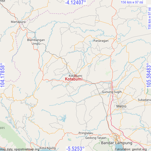
Kotabumi GPS coordinates[2]
4° 49' 30.18" South, 104° 52' 54.12" East
| Map corner | latitude | longitude |
|---|---|---|
| Upper-left | -4.12407°, | 104.17858° |
| Center: | -4.82505°, | 104.8817° |
| Lower-right: | -5.5253°, | 105.58483° |
| Map W x H: | 155.8×155.8 km | = 96.8×96.8mi |
| max Lat: | 5.88969° ⇑11.2% North |
| Kotabumi: | -4.82505° |
| min Lat: | ⇓88.8% South -10.934° |
| min Long | Kotabumi | max Long |
| 95.1345° | 104.8817° | 140.9419° |
| W 5.4%⇐ | ⇒94.6% E |
Elevation
Elevation of Kotabumi is 37 m = 121 ft, and this is 192.7 m = 632 ft below average elevation for this country.
| Max E: |
3185 m = 10449 ft | 67.4% |
| Avg. | 229.7 m = 754 ft | |
| Kotabumi | 37 m = 121 ft | |
Min E: |
-1 m = -3 ft | 32.6% |
See also: Kotabumi elevation on elevation.city.
Geographical zone
Kotabumi is located in South Torrid zone (between Equator and Tropic of Capricorn). Distance of Equator is 536.5 km =333.4 mi to North.| Distance of | km | miles | from Kotabumi |
|---|---|---|---|
| Equator | 536.5 | 333.4 | to North |
| Tropic Capricorn | 2069.4 | 1285.9 | to South |
| Antarctic Circle | 6864.7 | 4265.5 | to South |
| South Pole | 9470.6 | 5884.8 | to South |


Nearby cities:
15 places around Kotabumi: (largest is in red/bold)
• Bangunrejo
39.1 km =24.3 mi,  153°
153°
• Bara Datu
43.6 km =27.1 mi,  281°
281°
• Bukitkemuning
34.3 km =21.3 mi,  263°
263°
• Gunung Sugih
40.4 km =25.1 mi,  114°
114°
• Kalirejo
45.4 km =28.2 mi,  168°
168°
• Kasui
49.4 km =30.7 mi, 284°
• Ketapang
15.4 km =9.6 mi,  323°
323°
• Negararatu
24.8 km =15.4 mi, 319°
• Oganlima
20.3 km =12.6 mi, 256°
• Pakuan Agung
20 km =12.4 mi,  26°
26°
• Panaragan
44.5 km =27.7 mi, 29°
• Pasar Banjit
44.2 km =27.5 mi,  273°
273°
• Punggur
50 km =31.1 mi,  118°
118°
• Terbanggi Besar
37.8 km =23.5 mi,  99°
99°
• Umbulan Kapiak
39.1 km =24.3 mi, 268°
Sources, notices
• [Note1] Compared only with cities in Indonesia existing in our database
• [Src1] Map data: © OpenStreetMap contributors (CC-BY-SA)
• [Src2] Other city data from geonames.org with taken over terms of usage.
• [Src3] Geographical zone / Annual Mean Temperature by Robert A. Rohde @ Wikipedia
