Kalapagenep geodata
Kalapagenep (West Java) is a seat of a fourth-order administrative division; located in Indonesia in Asia/Jakarta (GMT+7) time zone. In our database, there are 407 cities with bigger population. Compared to other cities in Indonesia, 60.9% of cities are located further ↑North; 74.7% of cities are located further →East and 83% of cities have higher elevation than Kalapagenep. Note1


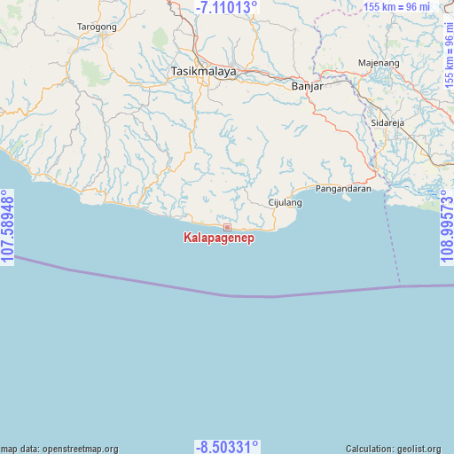
Kalapagenep GPS coordinates[2]
7° 48' 26.28" South, 108° 17' 33.36" East
| Map corner | latitude | longitude |
|---|---|---|
| Upper-left | -7.11013°, | 107.58948° |
| Center: | -7.8073°, | 108.2926° |
| Lower-right: | -8.50331°, | 108.99573° |
| Map W x H: | 154.9×154.9 km | = 96.3×96.3mi |
| max Lat: | 5.88969° ⇑60.9% North |
| Kalapagenep: | -7.8073° |
| min Lat: | ⇓39.1% South -10.934° |
| min Long | Kalapagenep | max Long |
| 95.1345° | 108.2926° | 140.9419° |
| W 25.3%⇐ | ⇒74.7% E |
Elevation
Elevation of Kalapagenep is 16 m = 52 ft, and this is 213.7 m = 701 ft below average elevation for this country.
| Max E: |
3185 m = 10449 ft | 83% |
| Avg. | 229.7 m = 754 ft | |
| Kalapagenep | 16 m = 52 ft | |
Min E: |
-1 m = -3 ft | 17% |
See also: Indonesia elevation on elevation.city.
Geographical zone
Kalapagenep is located in South Torrid zone (between Equator and Tropic of Capricorn). Distance of Equator is 868.1 km =539.4 mi to North.| Distance of | km | miles | from Kalapagenep |
|---|---|---|---|
| Equator | 868.1 | 539.4 | to North |
| Tropic Capricorn | 1737.8 | 1079.8 | to South |
| Antarctic Circle | 6533.1 | 4059.5 | to South |
| South Pole | 9139 | 5678.7 | to South |


Nearby cities:
15 places around Kalapagenep: (largest is in red/bold)
• Banjarwaru
10.3 km =6.4 mi,  71°
71°
• Cibunter
11.5 km =7.1 mi,  311°
311°
• Cibuntu
6.7 km =4.2 mi,  354°
354°
• Cikancra
10.8 km =6.7 mi,  304°
304°
• Cikijing
12.1 km =7.5 mi,  38°
38°
• Cipari
5.7 km =3.5 mi,  340°
340°
• Cireuma
8.3 km =5.2 mi,  94°
94°
• Citotok
12.1 km =7.5 mi, 93°
• Karanganyar
5.5 km =3.4 mi, 72°
• Leuwihalang
12.1 km =7.5 mi,  356°
356°
• Nangerang
9.4 km =5.8 mi, 307°
• Purwosari
9.4 km =5.8 mi,  29°
29°
• Rancabungur
8.1 km =5 mi, 349°
• Sindangsari
6.4 km =4 mi,  279°
279°
• Sukamenak
2.6 km =1.6 mi,  95°
95°
Sources, notices
• [Note1] Compared only with cities in Indonesia existing in our database
• [Src1] Map data: © OpenStreetMap contributors (CC-BY-SA)
• [Src2] Other city data from geonames.org with taken over terms of usage.
• [Src3] Geographical zone / Annual Mean Temperature by Robert A. Rohde @ Wikipedia
