Jatinagara geodata
Jatinagara (West Java) is a seat of a third-order administrative division; located in Indonesia in Asia/Jakarta (GMT+7) time zone. In our database, there are 407 cities with bigger population. Compared to other cities in Indonesia, 56.3% of cities are located further ↓South; 72.9% of cities are located further →East and 80.4% of cities have lower elevation than Jatinagara. Note1


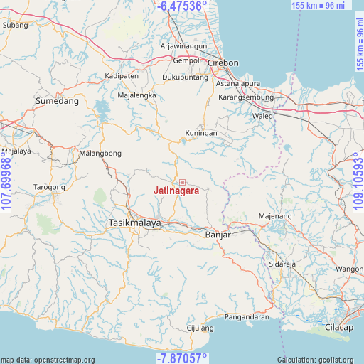
Jatinagara GPS coordinates[2]
7° 10' 24.6" South, 108° 24' 10.08" East
| Map corner | latitude | longitude |
|---|---|---|
| Upper-left | -6.47536°, | 107.69968° |
| Center: | -7.1735°, | 108.4028° |
| Lower-right: | -7.87057°, | 109.10593° |
| Map W x H: | 155.1×155.1 km | = 96.4×96.4mi |
| max Lat: | 5.88969° ⇑43.7% North |
| Jatinagara: | -7.1735° |
| min Lat: | ⇓56.3% South -10.934° |
| min Long | Jatinagara | max Long |
| 95.1345° | 108.4028° | 140.9419° |
| W 27.1%⇐ | ⇒72.9% E |
Elevation
Elevation of Jatinagara is 438 m = 1437 ft, and this is 208.3 m = 683 ft above average elevation for this country.
| Max E: |
3185 m = 10449 ft | 19.6% |
| Jatinagara | 438 m 1437 ft | |
| Avg. | 229.7 m = 754 ft | |
Min E: |
-1 m = -3 ft | 80.4% |
See also: Indonesia elevation on elevation.city.
Geographical zone
Jatinagara is located in South Torrid zone (between Equator and Tropic of Capricorn). Distance of Equator is 797.6 km =495.6 mi to North.| Distance of | km | miles | from Jatinagara |
|---|---|---|---|
| Equator | 797.6 | 495.6 | to North |
| Tropic Capricorn | 1808.3 | 1123.6 | to South |
| Antarctic Circle | 6603.6 | 4103.3 | to South |
| South Pole | 9209.4 | 5722.5 | to South |


Nearby cities:
15 places around Jatinagara: (largest is in red/bold)
• Bayasari Kulon
2.2 km =1.4 mi,  96°
96°
• Cibeuruy
4.2 km =2.6 mi,  48°
48°
• Cibingbin
3.7 km =2.3 mi,  105°
105°
• Cicadas
2.6 km =1.6 mi,  43°
43°
• Cigoong
3.3 km =2.1 mi, 107°
• Dayeuhluhur
1.9 km =1.2 mi,  264°
264°
• Jatinagara Kulon
1.8 km =1.1 mi,  84°
84°
• Kawali
3.8 km =2.4 mi,  249°
249°
• Kawalimukti
4.2 km =2.6 mi, 256°
• Kiaralawang
3.9 km =2.4 mi,  232°
232°
• Madura
3.9 km =2.4 mi,  317°
317°
• Pabuaran
3.8 km =2.4 mi, 79°
• Pangrumasan
3.5 km =2.2 mi,  171°
171°
• Pasiramis
1 km =0.6 mi,  332°
332°
• Rajadesa
3.6 km =2.2 mi, 108°
Sources, notices
• [Note1] Compared only with cities in Indonesia existing in our database
• [Src1] Map data: © OpenStreetMap contributors (CC-BY-SA)
• [Src2] Other city data from geonames.org with taken over terms of usage.
• [Src3] Geographical zone / Annual Mean Temperature by Robert A. Rohde @ Wikipedia
