Guranteng geodata
Guranteng (West Java) is a seat of a fourth-order administrative division; located in Indonesia in Asia/Jakarta (GMT+7) time zone. In our database, there are 407 cities with bigger population. Compared to other cities in Indonesia, 60.2% of cities are located further ↓South; 76.7% of cities are located further →East and 90.2% of cities have lower elevation than Guranteng. Note1


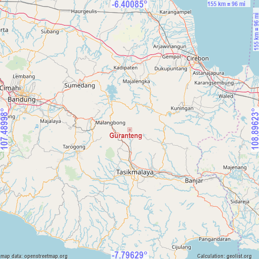
Guranteng GPS coordinates[2]
7° 5' 56.76" South, 108° 11' 35.16" East
| Map corner | latitude | longitude |
|---|---|---|
| Upper-left | -6.40085°, | 107.48998° |
| Center: | -7.0991°, | 108.1931° |
| Lower-right: | -7.79629°, | 108.89623° |
| Map W x H: | 155.2×155.2 km | = 96.4×96.4mi |
| max Lat: | 5.88969° ⇑39.8% North |
| Guranteng: | -7.0991° |
| min Lat: | ⇓60.2% South -10.934° |
| min Long | Guranteng | max Long |
| 95.1345° | 108.1931° | 140.9419° |
| W 23.3%⇐ | ⇒76.7% E |
Elevation
Elevation of Guranteng is 648 m = 2126 ft, and this is 418.3 m = 1372 ft above average elevation for this country.
| Max E: |
3185 m = 10449 ft | 9.8% |
| Guranteng | 648 m 2126 ft | |
| Avg. | 229.7 m = 754 ft | |
Min E: |
-1 m = -3 ft | 90.2% |
See also: Indonesia elevation on elevation.city.
Geographical zone
Guranteng is located in South Torrid zone (between Equator and Tropic of Capricorn). Distance of Equator is 789.3 km =490.4 mi to North.| Distance of | km | miles | from Guranteng |
|---|---|---|---|
| Equator | 789.3 | 490.4 | to North |
| Tropic Capricorn | 1816.6 | 1128.8 | to South |
| Antarctic Circle | 6611.8 | 4108.4 | to South |
| South Pole | 9217.7 | 5727.6 | to South |


Nearby cities:
15 places around Guranteng: (largest is in red/bold)
• Bojongbenteng
3.7 km =2.3 mi,  149°
149°
• Cicalung
4.8 km =3 mi,  170°
170°
• Cimanglid
2.3 km =1.4 mi,  208°
208°
• Ciseuti Girang
4.2 km =2.6 mi,  217°
217°
• Nanggewer
3.3 km =2.1 mi,  265°
265°
• Pagerageung
3.3 km =2.1 mi,  242°
242°
• Pagerageung Tengah
3.2 km =2 mi,  247°
247°
• Pamoyanan
5.2 km =3.2 mi, 236°
• Panoongan
4.6 km =2.9 mi,  162°
162°
• Puteran Kidul
2.3 km =1.4 mi, 161°
• Sindangbarang
2.6 km =1.6 mi,  32°
32°
• Sukamaju
3.9 km =2.4 mi,  204°
204°
• Sukapancar
5 km =3.1 mi, 195°
• Sukasenang
5 km =3.1 mi,  131°
131°
• Warudoyong
4.2 km =2.6 mi, 134°
Sources, notices
• [Note1] Compared only with cities in Indonesia existing in our database
• [Src1] Map data: © OpenStreetMap contributors (CC-BY-SA)
• [Src2] Other city data from geonames.org with taken over terms of usage.
• [Src3] Geographical zone / Annual Mean Temperature by Robert A. Rohde @ Wikipedia
