Gampang geodata
Gampang (East Java) is a seat of a third-order administrative division; located in Indonesia in Asia/Jakarta (GMT+7) time zone. In our database, there are 407 cities with bigger population. Compared to other cities in Indonesia, 69.3% of cities are located further ↓South; 52.2% of cities are located further ←West and 86.4% of cities have higher elevation than Gampang. Note1


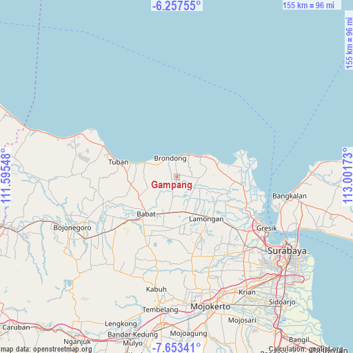
Gampang GPS coordinates[2]
6° 57' 21.6" South, 112° 17' 54.96" East
| Map corner | latitude | longitude |
|---|---|---|
| Upper-left | -6.25755°, | 111.59548° |
| Center: | -6.956°, | 112.2986° |
| Lower-right: | -7.65341°, | 113.00173° |
| Map W x H: | 155.2×155.2 km | = 96.4×96.4mi |
| max Lat: | 5.88969° ⇑30.7% North |
| Gampang: | -6.956° |
| min Lat: | ⇓69.3% South -10.934° |
| min Long | Gampang | max Long |
| 95.1345° | 112.2986° | 140.9419° |
| W 52.2%⇐ | ⇒47.8% E |
Elevation
Elevation of Gampang is 13 m = 43 ft, and this is 216.7 m = 711 ft below average elevation for this country.
| Max E: |
3185 m = 10449 ft | 86.4% |
| Avg. | 229.7 m = 754 ft | |
| Gampang | 13 m = 43 ft | |
Min E: |
-1 m = -3 ft | 13.6% |
See also: Indonesia elevation on elevation.city.
Geographical zone
Gampang is located in South Torrid zone (between Equator and Tropic of Capricorn). Distance of Equator is 773.4 km =480.6 mi to North.| Distance of | km | miles | from Gampang |
|---|---|---|---|
| Equator | 773.4 | 480.6 | to North |
| Tropic Capricorn | 1832.5 | 1138.7 | to South |
| Antarctic Circle | 6627.7 | 4118.3 | to South |
| South Pole | 9233.6 | 5737.5 | to South |


Nearby cities:
15 places around Gampang: (largest is in red/bold)
• Blumbang
2.2 km =1.4 mi,  148°
148°
• Dadapan
4.1 km =2.5 mi,  25°
25°
• Gedangan
1.4 km =0.9 mi,  176°
176°
• Jangkungkusumo
3.8 km =2.4 mi,  203°
203°
• Kanugrahan
4 km =2.5 mi, 179°
• Karangtawar
4.5 km =2.8 mi,  102°
102°
• Laren
2.4 km =1.5 mi,  187°
187°
• Pangkatrejo
2.9 km =1.8 mi, 194°
• Parengan
3.2 km =2 mi, 204°
• Pelangwot
3.9 km =2.4 mi,  212°
212°
• Prijek
3.4 km =2.1 mi,  121°
121°
• Pringgoboyo
2.8 km =1.7 mi, 183°
• Taman
3 km =1.9 mi,  143°
143°
• Tebluru
4.1 km =2.5 mi,  36°
36°
• Turi
3.6 km =2.2 mi,  169°
169°
Sources, notices
• [Note1] Compared only with cities in Indonesia existing in our database
• [Src1] Map data: © OpenStreetMap contributors (CC-BY-SA)
• [Src2] Other city data from geonames.org with taken over terms of usage.
• [Src3] Geographical zone / Annual Mean Temperature by Robert A. Rohde @ Wikipedia
