Pelangwot geodata
Pelangwot (East Java) is a seat of a fourth-order administrative division; located in Indonesia in Asia/Jakarta (GMT+7) time zone. In our database, there are 407 cities with bigger population. Compared to other cities in Indonesia, 67.3% of cities are located further ↓South; 51.9% of cities are located further ←West and 87.7% of cities have higher elevation than Pelangwot. Note1


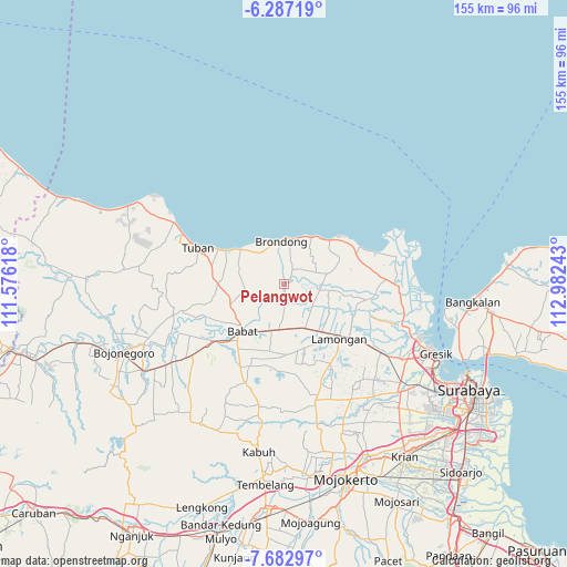
Pelangwot GPS coordinates[2]
6° 59' 8.16" South, 112° 16' 45.48" East
| Map corner | latitude | longitude |
|---|---|---|
| Upper-left | -6.28719°, | 111.57618° |
| Center: | -6.9856°, | 112.2793° |
| Lower-right: | -7.68297°, | 112.98243° |
| Map W x H: | 155.2×155.2 km | = 96.4×96.4mi |
| max Lat: | 5.88969° ⇑32.7% North |
| Pelangwot: | -6.9856° |
| min Lat: | ⇓67.3% South -10.934° |
| min Long | Pelangwot | max Long |
| 95.1345° | 112.2793° | 140.9419° |
| W 51.9%⇐ | ⇒48.1% E |
Elevation
Elevation of Pelangwot is 12 m = 39 ft, and this is 217.7 m = 714 ft below average elevation for this country.
| Max E: |
3185 m = 10449 ft | 87.7% |
| Avg. | 229.7 m = 754 ft | |
| Pelangwot | 12 m = 39 ft | |
Min E: |
-1 m = -3 ft | 12.3% |
See also: Indonesia elevation on elevation.city.
Geographical zone
Pelangwot is located in South Torrid zone (between Equator and Tropic of Capricorn). Distance of Equator is 776.7 km =482.6 mi to North.| Distance of | km | miles | from Pelangwot |
|---|---|---|---|
| Equator | 776.7 | 482.6 | to North |
| Tropic Capricorn | 1829.2 | 1136.6 | to South |
| Antarctic Circle | 6624.4 | 4116.2 | to South |
| South Pole | 9230.3 | 5735.4 | to South |


Nearby cities:
15 places around Pelangwot: (largest is in red/bold)
• Blumbang
3.6 km =2.2 mi,  66°
66°
• Gampang
3.9 km =2.4 mi,  32°
32°
• Gedangan
2.9 km =1.8 mi,  50°
50°
• Gelap
4.7 km =2.9 mi,  284°
284°
• Jangkungkusumo
0.6 km =0.4 mi,  107°
107°
• Kanugrahan
2.3 km =1.4 mi, 108°
• Karangrejo
4.8 km =3 mi,  99°
99°
• Laren
2 km =1.2 mi,  63°
63°
• Maduran
2.1 km =1.3 mi,  175°
175°
• Pangkatrejo
1.5 km =0.9 mi, 71°
• Parengan
0.9 km =0.6 mi, 64°
• Prijek
5.3 km =3.3 mi, 73°
• Pringgoboyo
2 km =1.2 mi,  76°
76°
• Taman
4 km =2.5 mi, 77°
• Turi
2.8 km =1.7 mi,  94°
94°
Sources, notices
• [Note1] Compared only with cities in Indonesia existing in our database
• [Src1] Map data: © OpenStreetMap contributors (CC-BY-SA)
• [Src2] Other city data from geonames.org with taken over terms of usage.
• [Src3] Geographical zone / Annual Mean Temperature by Robert A. Rohde @ Wikipedia
