Kefar H̱abad geodata
Kefar H̱abad (Central District) is a populated place; located in Israel in Asia/Jerusalem (GMT+3) time zone. With population of 4,771 people, there are 111 cities with bigger population in this country. Compared to other cities in Israel, 70.4% of cities are located further ↑North; 80.5% of cities are located further →East and 78.7% of cities have higher elevation than Kefar H̱abad. Note1


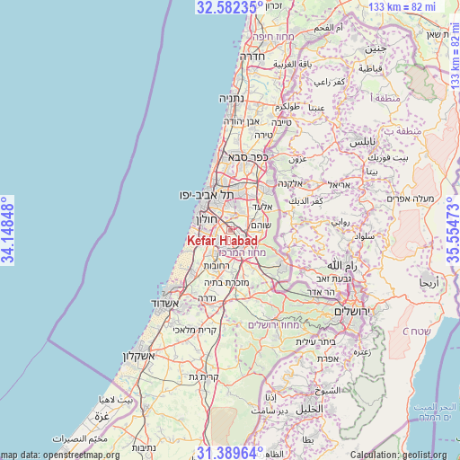
Kefar H̱abad GPS coordinates[2]
31° 59' 16.548" North, 34° 51' 5.76" East
| Map corner | latitude | longitude |
|---|---|---|
| Upper-left | 32.58235°, | 34.14848° |
| Center: | 31.98793°, | 34.8516° |
| Lower-right: | 31.38964°, | 35.55473° |
| Map W x H: | 132.6×132.6 km | = 82.4×82.4mi |
| max Lat: | 33.27918° ⇑70.4% North |
| Kefar H̱abad: | 31.98793° |
| min Lat: | ⇓29.6% South 29.55805° |
| min Long | Kefar H̱abad | max Long |
| 34.57149° | 34.8516° | 35.81084° |
| W 19.5%⇐ | ⇒80.5% E |
Elevation
Elevation of Kefar H̱abad is 43 m = 141 ft, and this is 180.4 m = 592 ft below average elevation for this country.
| Max E: |
988 m = 3241 ft | 78.7% |
| Avg. | 223.4 m = 733 ft | |
| Kefar H̱abad | 43 m = 141 ft | |
Min E: |
-380 m = -1247 ft | 21.3% |
See also: Israel elevation on elevation.city.
Geographical zone
Kefar H̱abad is located in North temperate zone (between Tropic of Cancer and the Arctic Circle). Distance of this Northern Tropic circle is 950.8 km =590.8 mi to South.| Distance of | km | miles | from Kefar H̱abad |
|---|---|---|---|
| North Pole | 6450.3 | 4008 | to North |
| Arctic Circle | 3844.4 | 2388.8 | to North |
| Tropic Cancer | 950.8 | 590.8 | to South |
| Equator | 3556.7 | 2210 | to South |


Nearby cities:
15 places around Kefar H̱abad: (largest is in red/bold)
• Azor
5.9 km =3.7 mi,  313°
313°
• Bet Dagan
2.6 km =1.6 mi, 307°
• Ganei Tikva
8.2 km =5.1 mi,  14°
14°
• Giv'at Shmuel
10 km =6.2 mi,  358°
358°
• H̱olon
7.3 km =4.5 mi,  290°
290°
• Lod
5.9 km =3.7 mi,  141°
141°
• Ness Ziona
8.2 km =5.1 mi,  217°
217°
• Neẖalim
9.8 km =6.1 mi,  34°
34°
• Or Yehuda
4.6 km =2.9 mi, 7°
• Ramla
6.7 km =4.2 mi,  168°
168°
• Rishon LeẔiyyon
6.2 km =3.9 mi,  252°
252°
• Savyon
7.3 km =4.5 mi,  19°
19°
• Shoham
8.9 km =5.5 mi,  82°
82°
• Yehud
6.2 km =3.9 mi,  36°
36°
• Yehud-Monosson
5.2 km =3.2 mi, 30°
Sources, notices
• [Note1] Compared only with cities in Israel existing in our database
• [Src1] Map data: © OpenStreetMap contributors (CC-BY-SA)
• [Src2] Other city data from geonames.org with taken over terms of usage.
• [Src3] Geographical zone / Annual Mean Temperature by Robert A. Rohde @ Wikipedia
