Kalakkādu geodata
Kalakkādu (Tamil Nadu) is a populated place; located in India in Asia/Kolkata (GMT+5.5) time zone. With population of 27,845 people, there are 1548 cities with bigger population in this country. Compared to other cities in India, 99.5% of cities are located further ↑North; 56.7% of cities are located further →East and 63.1% of cities have higher elevation than Kalakkādu. Note1


Kalakkādu GPS coordinates[2]
8° 30' 49.68" North, 77° 32' 57.984" East
| Map corner | latitude | longitude |
|---|---|---|
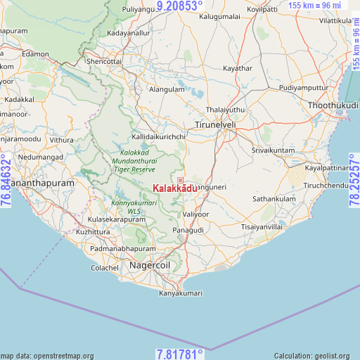
| Upper-left | 9.20853°, | 76.84632° |
| Center: | 8.5138°, | 77.54944° |
| Lower-right: | 7.81781°, | 78.25257° |
| Map W x H: | 154.6×154.6 km | = 96.1×96.1mi |
| max Lat: | 34.9274° ⇑99.5% North |
| Kalakkādu: | 8.5138° |
| min Lat: | ⇓0.5% South 8.09008° |
| min Long | Kalakkādu | max Long |
| 68.82655° | 77.54944° | 96.81° |
| W 43.3%⇐ | ⇒56.7% E |
Elevation
Elevation of Kalakkādu is 132 m = 433 ft, and this is 163.6 m = 537 ft below average elevation for this country.
| Max E: |
3681 m = 12077 ft | 63.1% |
| Avg. | 295.6 m = 970 ft | |
| Kalakkādu | 132 m = 433 ft | |
Min E: |
1 m = 3 ft | 36.9% |
See also: India elevation on elevation.city.
Geographical zone
Kalakkādu is located in North Torrid zone (between Equator and Tropic of Cancer). Distance of Equator is 946.6 km =588.2 mi to South.| Distance of | km | miles | from Kalakkādu |
|---|---|---|---|
| North Pole | 9060.4 | 5629.9 | to North |
| Arctic Circle | 6454.5 | 4010.6 | to North |
| Tropic Cancer | 1659.3 | 1031 | to North |
| Equator | 946.6 | 588.2 | to South |


Nearby cities:
15 places around Kalakkādu: (largest is in red/bold)
• Alwa Tirunagari
44.1 km =27.4 mi,  76°
76°
• Ambasamudram
24.4 km =15.2 mi,  333°
333°
• Eraniel
42.7 km =26.5 mi,  216°
216°
• Kallidaikurichi
21.2 km =13.2 mi, 334°
• Nanguneri
12.2 km =7.6 mi,  100°
100°
• Nāgercoil
39.4 km =24.5 mi,  199°
199°
• Padmanābhapuram
38.7 km =24 mi, 219°
• Sathankulam
40.8 km =25.4 mi, 101°
• Srivaikuntam
42 km =26.1 mi,  72°
72°
• Suchindram
41 km =25.5 mi,  192°
192°
• Tirunelveli
28 km =17.4 mi,  31°
31°
• Tisaiyanvilai
40.2 km =25 mi,  119°
119°
• Vadakku Valliyūr
16.1 km =10 mi,  154°
154°
• Vadakku Viravanallur
20.7 km =12.9 mi,  350°
350°
• Ālangulam
39.3 km =24.4 mi, 351°
Sources, notices
• [Note1] Compared only with cities in India existing in our database
• [Src1] Map data: © OpenStreetMap contributors (CC-BY-SA)
• [Src2] Other city data from geonames.org with taken over terms of usage.
• [Src3] Geographical zone / Annual Mean Temperature by Robert A. Rohde @ Wikipedia
