Verbicaro geodata
Verbicaro (Calabria) is a seat of a third-order administrative division; located in Italy in Europe/Rome (GMT+2) time zone. With population of 2,940 people, there are 3089 cities with bigger population in this country. Compared to other cities in Italy, 89.2% of cities are located further ↑North; 92.3% of cities are located further ←West and 76.9% of cities have lower elevation than Verbicaro. Note1


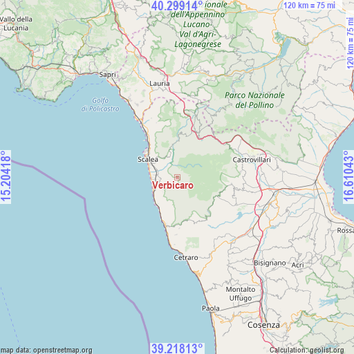
Verbicaro GPS coordinates[2]
39° 45' 38.736" North, 15° 54' 26.28" East
| Map corner | latitude | longitude |
|---|---|---|
| Upper-left | 40.29914°, | 15.20418° |
| Center: | 39.76076°, | 15.9073° |
| Lower-right: | 39.21813°, | 16.61043° |
| Map W x H: | 120.2×120.2 km | = 74.7×74.7mi |
| max Lat: | 47.04031° ⇑89.2% North |
| Verbicaro: | 39.76076° |
| min Lat: | ⇓10.8% South 35.50142° |
| min Long | Verbicaro | max Long |
| 6.69888° | 15.9073° | 18.48682° |
| W 92.3%⇐ | ⇒7.7% E |
Elevation
Elevation of Verbicaro is 478 m = 1568 ft, and this is 171.3 m = 562 ft above average elevation for this country.
| Max E: |
2085 m = 6841 ft | 23.1% |
| Verbicaro | 478 m 1568 ft | |
| Avg. | 306.7 m = 1006 ft | |
Min E: |
-4 m = -13 ft | 76.9% |
See also: Italy elevation on elevation.city.
Geographical zone
Verbicaro is located in North temperate zone (between Tropic of Cancer and the Arctic Circle). Distance of this Northern Tropic circle is 1815.1 km =1127.9 mi to South.| Distance of | km | miles | from Verbicaro |
|---|---|---|---|
| North Pole | 5586.1 | 3471 | to North |
| Arctic Circle | 2980.2 | 1851.8 | to North |
| Tropic Cancer | 1815.1 | 1127.9 | to South |
| Equator | 4421 | 2747.1 | to South |


Nearby cities:
15 places around Verbicaro: (largest is in red/bold)
• Buonvicino
8.2 km =5.1 mi,  193°
193°
• Cirella
9.8 km =6.1 mi,  237°
237°
• Cucco-Riviere
10.3 km =6.4 mi,  229°
229°
• Diamante
11.5 km =7.1 mi,  219°
219°
• Grisolia
5.9 km =3.7 mi, 228°
• Maierà
6.9 km =4.3 mi, 224°
• Marcellina
7.2 km =4.5 mi,  274°
274°
• Marina di Santa Maria del Cedro
8.6 km =5.3 mi, 265°
• Orsomarso
4.3 km =2.7 mi,  0°
0°
• Papasidero
12.3 km =7.6 mi,  359°
359°
• San Donato di Ninea
13.2 km =8.2 mi,  114°
114°
• San Nicola Arcella
13.8 km =8.6 mi,  311°
311°
• Santa Domenica Talao
7.9 km =4.9 mi,  324°
324°
• Santa Maria del Cedro
6.3 km =3.9 mi,  255°
255°
• Scalea
10.7 km =6.6 mi,  297°
297°
Sources, notices
• [Note1] Compared only with cities in Italy existing in our database
• [Src1] Map data: © OpenStreetMap contributors (CC-BY-SA)
• [Src2] Other city data from geonames.org with taken over terms of usage.
• [Src3] Geographical zone / Annual Mean Temperature by Robert A. Rohde @ Wikipedia
