Corleone geodata
Corleone (Sicily) is a seat of a third-order administrative division; located in Italy in Europe/Rome (GMT+2) time zone. With population of 10,290 people, there are 921 cities with bigger population in this country. Compared to other cities in Italy, 97.7% of cities are located further ↑North; 71.4% of cities are located further ←West and 82.2% of cities have lower elevation than Corleone. Note1


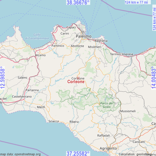
Corleone GPS coordinates[2]
37° 48' 48.168" North, 13° 18' 6.12" East
| Map corner | latitude | longitude |
|---|---|---|
| Upper-left | 38.36676°, | 12.59858° |
| Center: | 37.81338°, | 13.3017° |
| Lower-right: | 37.25582°, | 14.00483° |
| Map W x H: | 123.5×123.5 km | = 76.7×76.7mi |
| max Lat: | 47.04031° ⇑97.7% North |
| Corleone: | 37.81338° |
| min Lat: | ⇓2.3% South 35.50142° |
| min Long | Corleone | max Long |
| 6.69888° | 13.3017° | 18.48682° |
| W 71.4%⇐ | ⇒28.6% E |
Elevation
Elevation of Corleone is 558 m = 1831 ft, and this is 251.3 m = 824 ft above average elevation for this country.
| Max E: |
2085 m = 6841 ft | 17.8% |
| Corleone | 558 m 1831 ft | |
| Avg. | 306.7 m = 1006 ft | |
Min E: |
-4 m = -13 ft | 82.2% |
See also: Italy elevation on elevation.city.
Geographical zone
Corleone is located in North temperate zone (between Tropic of Cancer and the Arctic Circle). Distance of this Northern Tropic circle is 1598.5 km =993.3 mi to South.| Distance of | km | miles | from Corleone |
|---|---|---|---|
| North Pole | 5802.6 | 3605.6 | to North |
| Arctic Circle | 3196.7 | 1986.3 | to North |
| Tropic Cancer | 1598.5 | 993.3 | to South |
| Equator | 4204.5 | 2612.6 | to South |


Nearby cities:
15 places around Corleone: (largest is in red/bold)
• Bisacquino
12.7 km =7.9 mi,  196°
196°
• Campofelice di Fitalia
16.2 km =10.1 mi,  84°
84°
• Campofiorito
7.2 km =4.5 mi, 203°
• Cefalà Diana
18.2 km =11.3 mi,  51°
51°
• Chiusa Sclafani
15.4 km =9.6 mi,  190°
190°
• Contessa Entellina
13.9 km =8.6 mi,  228°
228°
• Giuliana
16.6 km =10.3 mi, 199°
• Godrano
14.9 km =9.3 mi, 48°
• Marineo
18.5 km =11.5 mi,  33°
33°
• Mezzojuso
15.5 km =9.6 mi,  68°
68°
• Palazzo Adriano
16.3 km =10.1 mi,  155°
155°
• Prizzi
15.5 km =9.6 mi,  131°
131°
• Roccamena
13.2 km =8.2 mi,  282°
282°
• Santa Cristina Gela
19.2 km =11.9 mi,  6°
6°
• Villafrati
19.1 km =11.9 mi,  57°
57°
Sources, notices
• [Note1] Compared only with cities in Italy existing in our database
• [Src1] Map data: © OpenStreetMap contributors (CC-BY-SA)
• [Src2] Other city data from geonames.org with taken over terms of usage.
• [Src3] Geographical zone / Annual Mean Temperature by Robert A. Rohde @ Wikipedia
