Catania geodata
Catania (Sicily) is a seat of a second-order administrative division; located in Italy in Europe/Rome (GMT+2) time zone. With population of 290,927 people, there are 8 cities with bigger population in this country. Compared to other cities in Italy, 98.9% of cities are located further ↑North; 87.7% of cities are located further ←West and 82.5% of cities have higher elevation than Catania. Note1
Administrative division(s):
- Level 1: Sicily
- Level 2: Catania
- Level 3: Catania
- Level 4: San Giorgio - Librino - S.G. La Rena - Zia Lisa


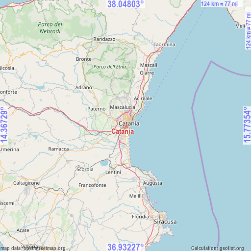
Catania GPS coordinates[2]
37° 29' 32.028" North, 15° 4' 13.476" East
| Map corner | latitude | longitude |
|---|---|---|
| Upper-left | 38.04803°, | 14.36729° |
| Center: | 37.49223°, | 15.07041° |
| Lower-right: | 36.93227°, | 15.77354° |
| Map W x H: | 124.1×124.1 km | = 77.1×77.1mi |
| max Lat: | 47.04031° ⇑98.9% North |
| Catania: | 37.49223° |
| min Lat: | ⇓1.1% South 35.50142° |
| min Long | Catania | max Long |
| 6.69888° | 15.07041° | 18.48682° |
| W 87.7%⇐ | ⇒12.3% E |
Elevation
Elevation of Catania is 40 m = 131 ft, and this is 266.7 m = 875 ft below average elevation for this country.
| Max E: |
2085 m = 6841 ft | 82.5% |
| Avg. | 306.7 m = 1006 ft | |
| Catania | 40 m = 131 ft | |
Min E: |
-4 m = -13 ft | 17.5% |
See also: Catania elevation on elevation.city.
Geographical zone
Catania is located in North temperate zone (between Tropic of Cancer and the Arctic Circle). Distance of this Northern Tropic circle is 1562.8 km =971.1 mi to South.| Distance of | km | miles | from Catania |
|---|---|---|---|
| North Pole | 5838.3 | 3627.8 | to North |
| Arctic Circle | 3232.4 | 2008.5 | to North |
| Tropic Cancer | 1562.8 | 971.1 | to South |
| Equator | 4168.7 | 2590.3 | to South |


Nearby cities:
15 places around Catania: (largest is in red/bold)
• Aci Castello
9.7 km =6 mi,  43°
43°
• Belvedere-Piano Tavola
8.4 km =5.2 mi,  299°
299°
• Camporotondo Etneo
10.1 km =6.3 mi,  324°
324°
• Canalicchio
5.9 km =3.7 mi,  22°
22°
• Carrubazza-Motta
7.6 km =4.7 mi,  26°
26°
• Cerza
6.4 km =4 mi, 28°
• Gravina di Catania
7.7 km =4.8 mi,  355°
355°
• Mascalucia
9.3 km =5.8 mi,  348°
348°
• Misterbianco
6.1 km =3.8 mi, 297°
• Motta Sant'Anastasia
9.4 km =5.8 mi,  283°
283°
• San Giovanni la Punta
9.6 km =6 mi,  12°
12°
• San Gregorio di Catania
9.1 km =5.7 mi, 23°
• San Pietro Clarenza
9.5 km =5.9 mi,  333°
333°
• Sant'Agata Li Battiati
7.3 km =4.5 mi, 6°
• Tremestieri Etneo
8.1 km =5 mi, 5°
Sources, notices
• [Note1] Compared only with cities in Italy existing in our database
• [Src1] Map data: © OpenStreetMap contributors (CC-BY-SA)
• [Src2] Other city data from geonames.org with taken over terms of usage.
• [Src3] Geographical zone / Annual Mean Temperature by Robert A. Rohde @ Wikipedia
