Castrignano del Capo geodata
Castrignano del Capo (Apulia) is a seat of a third-order administrative division; located in Italy in Europe/Rome (GMT+2) time zone. With population of 3,350 people, there are 2799 cities with bigger population in this country. Compared to other cities in Italy, 88.9% of cities are located further ↑North; 99.8% of cities are located further ←West and 65.8% of cities have higher elevation than Castrignano del Capo. Note1
Administrative division(s):
- Level 1: Apulia
- Level 2: Provincia di Lecce
- Level 3: Castrignano del Capo
Current local time in Castrignano del Capo:
03:30 PM, WednesdayDifference from your time zone: hours


Castrignano del Capo GPS coordinates[2]
39° 49' 58.08" North, 18° 21' 3.132" East
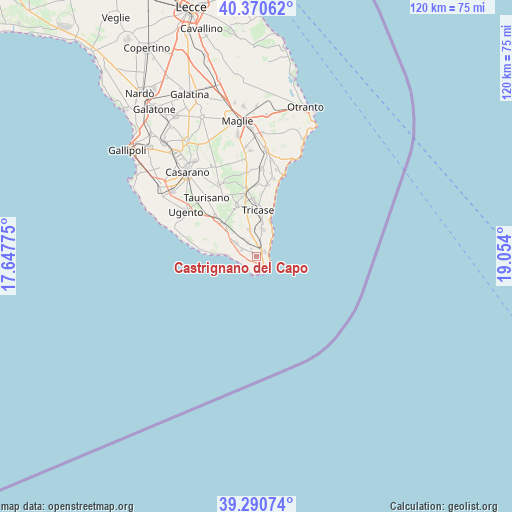
| Map corner | latitude | longitude |
|---|---|---|
| Upper-left | 40.37062°, | 17.64775° |
| Center: | 39.8328°, | 18.35087° |
| Lower-right: | 39.29074°, | 19.054° |
| Map W x H: | 120.1×120.1 km | = 74.6×74.6mi |
| max Lat: | 47.04031° ⇑88.9% North |
| Castrignano del Capo: | 39.8328° |
| min Lat: | ⇓11.1% South 35.50142° |
| min Long | Castrignano del | max Long |
| 6.69888° | 18.35087° | 18.48682° |
| W 99.8%⇐ | ⇒0.2% E |
Elevation
Elevation of Castrignano del Capo is 123 m = 404 ft, and this is 183.7 m = 603 ft below average elevation for this country.
| Max E: |
2085 m = 6841 ft | 65.8% |
| Avg. | 306.7 m = 1006 ft | |
| Castrignano del Capo | 123 m = 404 ft | |
Min E: |
-4 m = -13 ft | 34.2% |
See also: Italy elevation on elevation.city.
Geographical zone
Castrignano del Capo is located in North temperate zone (between Tropic of Cancer and the Arctic Circle). Distance of this Northern Tropic circle is 1823.1 km =1132.8 mi to South.| Distance of | km | miles | from Castrignano del Capo |
|---|---|---|---|
| North Pole | 5578.1 | 3466.1 | to North |
| Arctic Circle | 2972.2 | 1846.8 | to North |
| Tropic Cancer | 1823.1 | 1132.8 | to South |
| Equator | 4429 | 2752.1 | to South |


Nearby cities:
15 places around Castrignano del Capo: (largest is in red/bold)
• Alessano
7 km =4.3 mi,  346°
346°
• Barbarano del Capo
3.9 km =2.4 mi,  329°
329°
• Corsano
6.4 km =4 mi,  12°
12°
• Gagliano del Capo
2 km =1.2 mi,  54°
54°
• Giuliano
2.2 km =1.4 mi, 325°
• Leuca
3.8 km =2.4 mi,  170°
170°
• Lucugnano
11.6 km =7.2 mi, 347°
• Montesardo
4.9 km =3 mi, 348°
• Morciano di Leuca
3.8 km =2.4 mi,  295°
295°
• Patù
1.4 km =0.9 mi,  308°
308°
• Presicce
10.6 km =6.6 mi,  315°
315°
• Ruggiano
5.1 km =3.2 mi, 324°
• Salve
5.7 km =3.5 mi, 303°
• Tiggiano
7.9 km =4.9 mi, 8°
• Tricase
10.8 km =6.7 mi,  1°
1°
Sources, notices
• [Note1] Compared only with cities in Italy existing in our database
• [Src1] Map data: © OpenStreetMap contributors (CC-BY-SA)
• [Src2] Other city data from geonames.org with taken over terms of usage.
• [Src3] Geographical zone / Annual Mean Temperature by Robert A. Rohde @ Wikipedia
