Torre le Nocelle geodata
Torre le Nocelle (Campania) is a seat of a third-order administrative division; located in Italy in Europe/Rome (GMT+2) time zone. With population of 511 people, there are 9811 cities with bigger population in this country. Compared to other cities in Italy, 78.4% of cities are located further ↑North; 86.4% of cities are located further ←West and 73.3% of cities have lower elevation than Torre le Nocelle. Note1
Administrative division(s):
- Level 1: Campania
- Level 2: Provincia di Avellino
- Level 3: Torre Le Nocelle


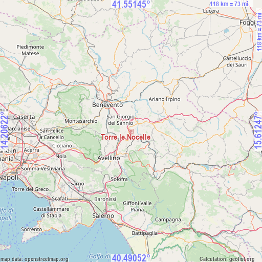
Torre le Nocelle GPS coordinates[2]
41° 1' 23.232" North, 14° 54' 33.624" East
| Map corner | latitude | longitude |
|---|---|---|
| Upper-left | 41.55145°, | 14.20622° |
| Center: | 41.02312°, | 14.90934° |
| Lower-right: | 40.49052°, | 15.61247° |
| Map W x H: | 118×118 km | = 73.3×73.3mi |
| max Lat: | 47.04031° ⇑78.4% North |
| Torre le Nocelle: | 41.02312° |
| min Lat: | ⇓21.6% South 35.50142° |
| min Long | Torre le Nocell | max Long |
| 6.69888° | 14.90934° | 18.48682° |
| W 86.4%⇐ | ⇒13.6% E |
Elevation
Elevation of Torre le Nocelle is 429 m = 1407 ft, and this is 122.3 m = 401 ft above average elevation for this country.
| Max E: |
2085 m = 6841 ft | 26.7% |
| Torre le Nocelle | 429 m 1407 ft | |
| Avg. | 306.7 m = 1006 ft | |
Min E: |
-4 m = -13 ft | 73.3% |
See also: Italy elevation on elevation.city.
Geographical zone
Torre le Nocelle is located in North temperate zone (between Tropic of Cancer and the Arctic Circle). Distance of this Northern Tropic circle is 1955.4 km =1215 mi to South.| Distance of | km | miles | from Torre le Nocelle |
|---|---|---|---|
| North Pole | 5445.7 | 3383.8 | to North |
| Arctic Circle | 2839.8 | 1764.6 | to North |
| Tropic Cancer | 1955.4 | 1215 | to South |
| Equator | 4561.3 | 2834.3 | to South |


Nearby cities:
15 places around Torre le Nocelle: (largest is in red/bold)
• Calvi
6.5 km =4 mi,  325°
325°
• Campanarello
2.7 km =1.7 mi,  8°
8°
• Lapio
5.4 km =3.4 mi,  145°
145°
• Montaperto
2.3 km =1.4 mi,  214°
214°
• Montefusco
4.8 km =3 mi,  288°
288°
• Montemiletto
1.5 km =0.9 mi, 210°
• Pietradefusi
3.1 km =1.9 mi,  316°
316°
• Pratola Serra
6.3 km =3.9 mi,  230°
230°
• San Giacomo
6.9 km =4.3 mi,  308°
308°
• San Giorgio del Sannio
6.9 km =4.3 mi, 316°
• San Nazzaro
5.4 km =3.4 mi, 306°
• Sant'Elena Irpina
2.3 km =1.4 mi, 313°
• Santa Paolina
5.3 km =3.3 mi,  268°
268°
• Taurasi
4.4 km =2.7 mi,  107°
107°
• Venticano
2.7 km =1.7 mi,  4°
4°
Sources, notices
• [Note1] Compared only with cities in Italy existing in our database
• [Src1] Map data: © OpenStreetMap contributors (CC-BY-SA)
• [Src2] Other city data from geonames.org with taken over terms of usage.
• [Src3] Geographical zone / Annual Mean Temperature by Robert A. Rohde @ Wikipedia
