Staffa geodata
Staffa (Piedmont) is a seat of a third-order administrative division; located in Italy in Europe/Rome (GMT+2) time zone. With population of 253 people, there are 10883 cities with bigger population in this country. Compared to other cities in Italy, 91.1% of cities are located further ↓South; 94% of cities are located further →East and 99.1% of cities have lower elevation than Staffa. Note1
Administrative division(s):
- Level 1: Piedmont
- Level 2: Provincia Verbano-Cusio-Ossola
- Level 3: Macugnaga


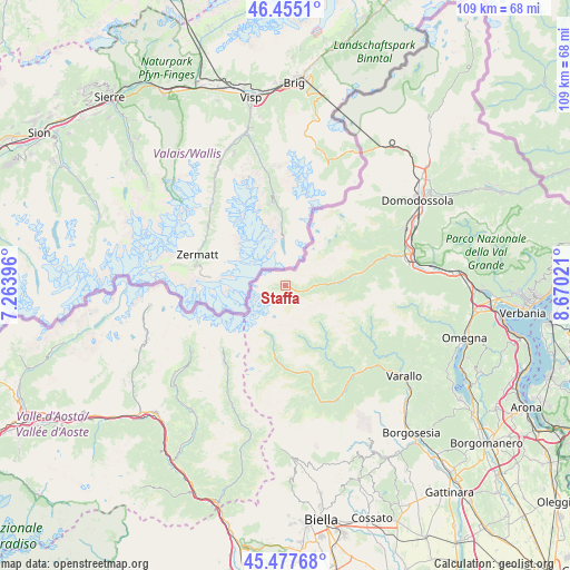
Staffa GPS coordinates[2]
45° 58' 6.78" North, 7° 58' 1.488" East
| Map corner | latitude | longitude |
|---|---|---|
| Upper-left | 46.4551°, | 7.26396° |
| Center: | 45.96855°, | 7.96708° |
| Lower-right: | 45.47768°, | 8.67021° |
| Map W x H: | 108.7×108.7 km | = 67.5×67.5mi |
| max Lat: | 47.04031° ⇑8.9% North |
| Staffa: | 45.96855° |
| min Lat: | ⇓91.1% South 35.50142° |
| min Long | Staffa | max Long |
| 6.69888° | 7.96708° | 18.48682° |
| W 6%⇐ | ⇒94% E |
Elevation
Elevation of Staffa is 1311 m = 4301 ft, and this is 1004.3 m = 3295 ft above average elevation for this country.
| Max E: |
2085 m = 6841 ft | 0.90000000000001% |
| Staffa | 1311 m 4301 ft | |
| Avg. | 306.7 m = 1006 ft | |
Min E: |
-4 m = -13 ft | 99.1% |
See also: Italy elevation on elevation.city.
Geographical zone
Staffa is located in North temperate zone (between Tropic of Cancer and the Arctic Circle). Distance of this North polar circle is 2290 km =1422.9 mi to North.| Distance of | km | miles | from Staffa |
|---|---|---|---|
| North Pole | 4895.8 | 3042.1 | to North |
| Arctic Circle | 2290 | 1422.9 | to North |
| Tropic Cancer | 2505.3 | 1556.7 | to South |
| Equator | 5111.2 | 3176 | to South |


Nearby cities:
15 places around Staffa: (largest is in red/bold)
• Alagna Valsesia
13.2 km =8.2 mi,  189°
189°
• Antrona Schieranco
15.3 km =9.5 mi,  48°
48°
• Antronapiana
15.4 km =9.6 mi, 48°
• Bannio
13.9 km =8.6 mi,  82°
82°
• Carcoforo
9.2 km =5.7 mi,  136°
136°
• Ceppo Morelli
7.7 km =4.8 mi,  87°
87°
• Cervatto
17.8 km =11.1 mi,  122°
122°
• Fobello
17.2 km =10.7 mi, 120°
• Macugnaga
0.1 km =0.1 mi,  35°
35°
• Mollia
17.6 km =10.9 mi,  163°
163°
• Rima
9.6 km =6 mi,  165°
165°
• Rimasco
14.2 km =8.8 mi,  148°
148°
• Rimella
17.9 km =11.1 mi,  112°
112°
• Riva Valdobbia
15.3 km =9.5 mi,  183°
183°
• Vanzone
11 km =6.8 mi, 84°
Sources, notices
• [Note1] Compared only with cities in Italy existing in our database
• [Src1] Map data: © OpenStreetMap contributors (CC-BY-SA)
• [Src2] Other city data from geonames.org with taken over terms of usage.
• [Src3] Geographical zone / Annual Mean Temperature by Robert A. Rohde @ Wikipedia
