Sorbolo geodata
Sorbolo (Emilia-Romagna) is a seat of a third-order administrative division; located in Italy in Europe/Rome (GMT+2) time zone. With population of 7,137 people, there are 1372 cities with bigger population in this country. Compared to other cities in Italy, 57% of cities are located further ↓South; 63.4% of cities are located further →East and 83.7% of cities have higher elevation than Sorbolo. Note1
Administrative division(s):
- Level 1: Emilia-Romagna
- Level 2: Provincia di Parma
- Level 3: Sorbolo Mezzani


Sorbolo GPS coordinates[2]
44° 50' 45.132" North, 10° 26' 37.5" East
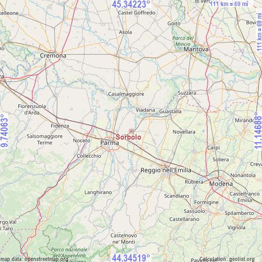
| Map corner | latitude | longitude |
|---|---|---|
| Upper-left | 45.34223°, | 9.74063° |
| Center: | 44.84587°, | 10.44375° |
| Lower-right: | 44.34519°, | 11.14688° |
| Map W x H: | 110.9×110.9 km | = 68.9×68.9mi |
| max Lat: | 47.04031° ⇑43% North |
| Sorbolo: | 44.84587° |
| min Lat: | ⇓57% South 35.50142° |
| min Long | Sorbolo | max Long |
| 6.69888° | 10.44375° | 18.48682° |
| W 36.6%⇐ | ⇒63.4% E |
Elevation
Elevation of Sorbolo is 35 m = 115 ft, and this is 271.7 m = 891 ft below average elevation for this country.
| Max E: |
2085 m = 6841 ft | 83.7% |
| Avg. | 306.7 m = 1006 ft | |
| Sorbolo | 35 m = 115 ft | |
Min E: |
-4 m = -13 ft | 16.3% |
See also: Italy elevation on elevation.city.
Geographical zone
Sorbolo is located in North temperate zone (between Tropic of Cancer and the Arctic Circle). Distance of this Northern Tropic circle is 2380.5 km =1479.2 mi to South.| Distance of | km | miles | from Sorbolo |
|---|---|---|---|
| North Pole | 5020.7 | 3119.7 | to North |
| Arctic Circle | 2414.8 | 1500.5 | to North |
| Tropic Cancer | 2380.5 | 1479.2 | to South |
| Equator | 4986.4 | 3098.4 | to South |


Nearby cities:
15 places around Sorbolo: (largest is in red/bold)
• Brescello
7.7 km =4.8 mi,  44°
44°
• Caprara
9.5 km =5.9 mi,  145°
145°
• Casale
7.9 km =4.9 mi,  353°
353°
• Casale di Mezzani
7.8 km =4.8 mi, 352°
• Case Cocconi
8.9 km =5.5 mi,  134°
134°
• Lentigione-Sorbolo a Mane
3.9 km =2.4 mi,  53°
53°
• Mezzano Inferiore
7.5 km =4.7 mi,  8°
8°
• Mezzano Superiore
9.7 km =6 mi, 351°
• Poviglio
7.5 km =4.7 mi,  93°
93°
• Praticello
5.2 km =3.2 mi, 153°
• Praticello di Gattatico
5.2 km =3.2 mi, 151°
• San Polo
8.4 km =5.2 mi,  305°
305°
• San Prospero
8.4 km =5.2 mi,  203°
203°
• Sant'Ilario d'Enza
9.7 km =6 mi,  178°
178°
• Taneto
8.3 km =5.2 mi,  173°
173°
Sources, notices
• [Note1] Compared only with cities in Italy existing in our database
• [Src1] Map data: © OpenStreetMap contributors (CC-BY-SA)
• [Src2] Other city data from geonames.org with taken over terms of usage.
• [Src3] Geographical zone / Annual Mean Temperature by Robert A. Rohde @ Wikipedia
