Lentigione-Sorbolo a Mane geodata
Lentigione-Sorbolo a Mane (Emilia-Romagna) is a populated place; located in Italy in Europe/Rome (GMT+2) time zone. With population of 2,218 people, there are 3848 cities with bigger population in this country. Compared to other cities in Italy, 57.4% of cities are located further ↓South; 63% of cities are located further →East and 85.6% of cities have higher elevation than Lentigione-Sorbolo a Mane. Note1
Administrative division(s):
- Level 1: Emilia-Romagna
- Level 2: Provincia di Reggio Emilia
- Level 3: Brescello
Current local time in Lentigione-Sorbolo a Mane:
11:20 PM, WednesdayDifference from your time zone: hours


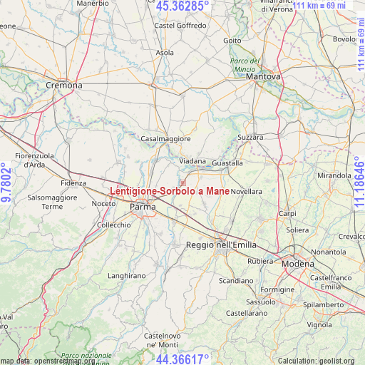
Lentigione-Sorbolo a Mane GPS coordinates[2]
44° 52' 0.012" North, 10° 28' 59.988" East
| Map corner | latitude | longitude |
|---|---|---|
| Upper-left | 45.36285°, | 9.7802° |
| Center: | 44.86667°, | 10.48333° |
| Lower-right: | 44.36617°, | 11.18646° |
| Map W x H: | 110.8×110.8 km | = 68.8×68.8mi |
| max Lat: | 47.04031° ⇑42.6% North |
| Lentigione-Sorbolo a Mane: | 44.86667° |
| min Lat: | ⇓57.4% South 35.50142° |
| min Long | Lentigione-Sorb | max Long |
| 6.69888° | 10.48333° | 18.48682° |
| W 37%⇐ | ⇒63% E |
Elevation
Elevation of Lentigione-Sorbolo a Mane is 29 m = 95 ft, and this is 277.7 m = 911 ft below average elevation for this country.
| Max E: |
2085 m = 6841 ft | 85.6% |
| Avg. | 306.7 m = 1006 ft | |
| Lentigione-Sorbolo a Mane | 29 m = 95 ft | |
Min E: |
-4 m = -13 ft | 14.4% |
See also: Italy elevation on elevation.city.
Geographical zone
Lentigione-Sorbolo a Mane is located in North temperate zone (between Tropic of Cancer and the Arctic Circle). Distance of this Northern Tropic circle is 2382.8 km =1480.6 mi to South.| Distance of | km | miles | from Lentigione-Sorbolo a Mane |
|---|---|---|---|
| North Pole | 5018.4 | 3118.3 | to North |
| Arctic Circle | 2412.5 | 1499.1 | to North |
| Tropic Cancer | 2382.8 | 1480.6 | to South |
| Equator | 4988.7 | 3099.8 | to South |


Nearby cities:
15 places around Lentigione-Sorbolo a Mane: (largest is in red/bold)
• Boretto
6.6 km =4.1 mi,  54°
54°
• Brescello
3.9 km =2.4 mi,  35°
35°
• Casale
6.9 km =4.3 mi,  323°
323°
• Casale di Mezzani
6.8 km =4.2 mi, 322°
• Case Cocconi
9.2 km =5.7 mi,  159°
159°
• Castelnovo di Sotto
8.9 km =5.5 mi,  132°
132°
• Meletole
8 km =5 mi,  104°
104°
• Mezzano Inferiore
5.5 km =3.4 mi,  339°
339°
• Mezzano Superiore
8.6 km =5.3 mi,  327°
327°
• Poviglio
5.2 km =3.2 mi,  121°
121°
• Praticello
7 km =4.3 mi,  186°
186°
• Praticello di Gattatico
6.9 km =4.3 mi, 185°
• Roncadello
9 km =5.6 mi,  354°
354°
• Sorbolo
3.9 km =2.4 mi,  233°
233°
• Viadana
8.2 km =5.1 mi,  20°
20°
Sources, notices
• [Note1] Compared only with cities in Italy existing in our database
• [Src1] Map data: © OpenStreetMap contributors (CC-BY-SA)
• [Src2] Other city data from geonames.org with taken over terms of usage.
• [Src3] Geographical zone / Annual Mean Temperature by Robert A. Rohde @ Wikipedia
