Serravalle Langhe geodata
Serravalle Langhe (Piedmont) is a seat of a third-order administrative division; located in Italy in Europe/Rome (GMT+2) time zone. With population of 160 people, there are 11249 cities with bigger population in this country. Compared to other cities in Italy, 51.8% of cities are located further ↓South; 92.8% of cities are located further →East and 90.7% of cities have lower elevation than Serravalle Langhe. Note1
Administrative division(s):
- Level 1: Piedmont
- Level 2: Provincia di Cuneo
- Level 3: Serravalle Langhe


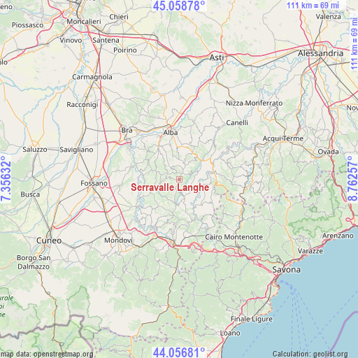
Serravalle Langhe GPS coordinates[2]
44° 33' 35.82" North, 8° 3' 33.984" East
| Map corner | latitude | longitude |
|---|---|---|
| Upper-left | 45.05878°, | 7.35632° |
| Center: | 44.55995°, | 8.05944° |
| Lower-right: | 44.05681°, | 8.76257° |
| Map W x H: | 111.4×111.4 km | = 69.2×69.2mi |
| max Lat: | 47.04031° ⇑48.2% North |
| Serravalle Langhe: | 44.55995° |
| min Lat: | ⇓51.8% South 35.50142° |
| min Long | Serravalle Lang | max Long |
| 6.69888° | 8.05944° | 18.48682° |
| W 7.2%⇐ | ⇒92.8% E |
Elevation
Elevation of Serravalle Langhe is 738 m = 2421 ft, and this is 431.3 m = 1415 ft above average elevation for this country.
| Max E: |
2085 m = 6841 ft | 9.3% |
| Serravalle Langhe | 738 m 2421 ft | |
| Avg. | 306.7 m = 1006 ft | |
Min E: |
-4 m = -13 ft | 90.7% |
See also: Italy elevation on elevation.city.
Geographical zone
Serravalle Langhe is located in North temperate zone (between Tropic of Cancer and the Arctic Circle). Distance of this Northern Tropic circle is 2348.7 km =1459.4 mi to South.| Distance of | km | miles | from Serravalle Langhe |
|---|---|---|---|
| North Pole | 5052.5 | 3139.5 | to North |
| Arctic Circle | 2446.6 | 1520.2 | to North |
| Tropic Cancer | 2348.7 | 1459.4 | to South |
| Equator | 4954.6 | 3078.6 | to South |


Nearby cities:
15 places around Serravalle Langhe: (largest is in red/bold)
• Albaretto della Torre
4.1 km =2.5 mi,  5°
5°
• Arguello
4.8 km =3 mi,  58°
58°
• Bonvicino
7.1 km =4.4 mi,  207°
207°
• Bossolasco
3.6 km =2.2 mi,  192°
192°
• Cerreto Langhe
3.5 km =2.2 mi, 61°
• Cissone
2.3 km =1.4 mi,  278°
278°
• Cravanzana
5.6 km =3.5 mi,  73°
73°
• Feisoglio
4 km =2.5 mi,  116°
116°
• Lequio Berria
6 km =3.7 mi,  30°
30°
• Montelupo Albese
6.9 km =4.3 mi,  351°
351°
• Niella Belbo
5.5 km =3.4 mi,  162°
162°
• Roddino
3.5 km =2.2 mi,  295°
295°
• Serralunga d'Alba
7.3 km =4.5 mi,  319°
319°
• Sinio
5.5 km =3.4 mi,  325°
325°
• Somano
4.9 km =3 mi,  236°
236°
Sources, notices
• [Note1] Compared only with cities in Italy existing in our database
• [Src1] Map data: © OpenStreetMap contributors (CC-BY-SA)
• [Src2] Other city data from geonames.org with taken over terms of usage.
• [Src3] Geographical zone / Annual Mean Temperature by Robert A. Rohde @ Wikipedia
