San Vito geodata
San Vito (Lombardy) is a populated place; located in Italy in Europe/Rome (GMT+2) time zone. With population of 843 people, there are 7431 cities with bigger population in this country. Compared to other cities in Italy, 70.8% of cities are located further ↓South; 81.1% of cities are located further →East and 66.2% of cities have higher elevation than San Vito. Note1
Administrative division(s):
- Level 1: Lombardy
- Level 2: Città metropolitana di Milano
- Level 3: Gaggiano


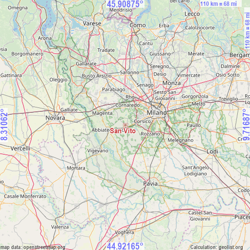
San Vito GPS coordinates[2]
45° 25' 2.496" North, 9° 0' 49.464" East
| Map corner | latitude | longitude |
|---|---|---|
| Upper-left | 45.90875°, | 8.31062° |
| Center: | 45.41736°, | 9.01374° |
| Lower-right: | 44.92165°, | 9.71687° |
| Map W x H: | 109.8×109.8 km | = 68.2×68.2mi |
| max Lat: | 47.04031° ⇑29.2% North |
| San Vito: | 45.41736° |
| min Lat: | ⇓70.8% South 35.50142° |
| min Long | San Vito | max Long |
| 6.69888° | 9.01374° | 18.48682° |
| W 18.9%⇐ | ⇒81.1% E |
Elevation
Elevation of San Vito is 120 m = 394 ft, and this is 186.7 m = 613 ft below average elevation for this country.
| Max E: |
2085 m = 6841 ft | 66.2% |
| Avg. | 306.7 m = 1006 ft | |
| San Vito | 120 m = 394 ft | |
Min E: |
-4 m = -13 ft | 33.8% |
See also: Italy elevation on elevation.city.
Geographical zone
San Vito is located in North temperate zone (between Tropic of Cancer and the Arctic Circle). Distance of this North polar circle is 2351.2 km =1461 mi to North.| Distance of | km | miles | from San Vito |
|---|---|---|---|
| North Pole | 4957.1 | 3080.2 | to North |
| Arctic Circle | 2351.2 | 1461 | to North |
| Tropic Cancer | 2444 | 1518.6 | to South |
| Equator | 5049.9 | 3137.9 | to South |


Nearby cities:
15 places around San Vito: (largest is in red/bold)
• Albairate
6 km =3.7 mi,  272°
272°
• Bareggio
7 km =4.3 mi,  349°
349°
• Cerello-Battuello
7.3 km =4.5 mi,  297°
297°
• Cesano Boscone
6.9 km =4.3 mi,  66°
66°
• Cisliano
3.6 km =2.2 mi,  324°
324°
• Cusago
4.1 km =2.5 mi,  27°
27°
• Gaggiano
2.2 km =1.4 mi,  130°
130°
• Gudo Visconti
4.9 km =3 mi,  192°
192°
• Monzoro
5.2 km =3.2 mi, 25°
• Noviglio
7.1 km =4.4 mi,  155°
155°
• Romano Banco
7.3 km =4.5 mi,  85°
85°
• Trezzano sul Naviglio
3.9 km =2.4 mi,  82°
82°
• Vermezzo
3.6 km =2.2 mi,  229°
229°
• Vigano
4.1 km =2.5 mi, 162°
• Zelo Surrigone
4 km =2.5 mi,  214°
214°
Sources, notices
• [Note1] Compared only with cities in Italy existing in our database
• [Src1] Map data: © OpenStreetMap contributors (CC-BY-SA)
• [Src2] Other city data from geonames.org with taken over terms of usage.
• [Src3] Geographical zone / Annual Mean Temperature by Robert A. Rohde @ Wikipedia
