Cusago geodata
Cusago (Lombardy) is a seat of a third-order administrative division; located in Italy in Europe/Rome (GMT+2) time zone. With population of 2,379 people, there are 3663 cities with bigger population in this country. Compared to other cities in Italy, 71.9% of cities are located further ↓South; 80.7% of cities are located further →East and 65.1% of cities have higher elevation than Cusago. Note1
Administrative division(s):
- Level 1: Lombardy
- Level 2: Città metropolitana di Milano
- Level 3: Cusago


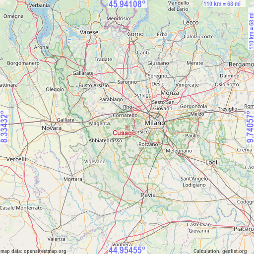
Cusago GPS coordinates[2]
45° 26' 59.892" North, 9° 2' 14.784" East
| Map corner | latitude | longitude |
|---|---|---|
| Upper-left | 45.94108°, | 8.33432° |
| Center: | 45.44997°, | 9.03744° |
| Lower-right: | 44.95455°, | 9.74057° |
| Map W x H: | 109.7×109.7 km | = 68.2×68.2mi |
| max Lat: | 47.04031° ⇑28.1% North |
| Cusago: | 45.44997° |
| min Lat: | ⇓71.9% South 35.50142° |
| min Long | Cusago | max Long |
| 6.69888° | 9.03744° | 18.48682° |
| W 19.3%⇐ | ⇒80.7% E |
Elevation
Elevation of Cusago is 127 m = 417 ft, and this is 179.7 m = 590 ft below average elevation for this country.
| Max E: |
2085 m = 6841 ft | 65.1% |
| Avg. | 306.7 m = 1006 ft | |
| Cusago | 127 m = 417 ft | |
Min E: |
-4 m = -13 ft | 34.9% |
See also: Italy elevation on elevation.city.
Geographical zone
Cusago is located in North temperate zone (between Tropic of Cancer and the Arctic Circle). Distance of this North polar circle is 2347.6 km =1458.7 mi to North.| Distance of | km | miles | from Cusago |
|---|---|---|---|
| North Pole | 4953.5 | 3078 | to North |
| Arctic Circle | 2347.6 | 1458.7 | to North |
| Tropic Cancer | 2447.6 | 1520.9 | to South |
| Equator | 5053.6 | 3140.2 | to South |


Nearby cities:
15 places around Cusago: (largest is in red/bold)
• Bareggio
4.5 km =2.8 mi,  316°
316°
• Buccinasco
7.3 km =4.5 mi,  130°
130°
• Cesano Boscone
4.5 km =2.8 mi,  101°
101°
• Cisliano
4 km =2.5 mi,  259°
259°
• Cornaredo
5.8 km =3.6 mi,  351°
351°
• Corsico
6.1 km =3.8 mi,  110°
110°
• Figino
5.7 km =3.5 mi,  33°
33°
• Gaggiano
5 km =3.1 mi,  182°
182°
• Monzoro
1.1 km =0.7 mi,  21°
21°
• Romano Banco
6.2 km =3.9 mi,  118°
118°
• San Vito
4.1 km =2.5 mi,  207°
207°
• Sedriano
6.9 km =4.3 mi,  311°
311°
• Settimo Milanese
3.4 km =2.1 mi, 24°
• Trezzano sul Naviglio
3.7 km =2.3 mi,  146°
146°
• Vighignolo
5.1 km =3.2 mi,  4°
4°
Sources, notices
• [Note1] Compared only with cities in Italy existing in our database
• [Src1] Map data: © OpenStreetMap contributors (CC-BY-SA)
• [Src2] Other city data from geonames.org with taken over terms of usage.
• [Src3] Geographical zone / Annual Mean Temperature by Robert A. Rohde @ Wikipedia
