Omignano geodata
Omignano (Campania) is a seat of a third-order administrative division; located in Italy in Europe/Rome (GMT+2) time zone. With population of 424 people, there are 10184 cities with bigger population in this country. Compared to other cities in Italy, 86.1% of cities are located further ↑North; 87.8% of cities are located further ←West and 81.3% of cities have lower elevation than Omignano. Note1


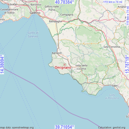
Omignano GPS coordinates[2]
40° 14' 57.552" North, 15° 5' 2.616" East
| Map corner | latitude | longitude |
|---|---|---|
| Upper-left | 40.78384°, | 14.38094° |
| Center: | 40.24932°, | 15.08406° |
| Lower-right: | 39.71054°, | 15.78719° |
| Map W x H: | 119.3×119.3 km | = 74.1×74.1mi |
| max Lat: | 47.04031° ⇑86.1% North |
| Omignano: | 40.24932° |
| min Lat: | ⇓13.9% South 35.50142° |
| min Long | Omignano | max Long |
| 6.69888° | 15.08406° | 18.48682° |
| W 87.8%⇐ | ⇒12.2% E |
Elevation
Elevation of Omignano is 543 m = 1781 ft, and this is 236.3 m = 775 ft above average elevation for this country.
| Max E: |
2085 m = 6841 ft | 18.7% |
| Omignano | 543 m 1781 ft | |
| Avg. | 306.7 m = 1006 ft | |
Min E: |
-4 m = -13 ft | 81.3% |
See also: Italy elevation on elevation.city.
Geographical zone
Omignano is located in North temperate zone (between Tropic of Cancer and the Arctic Circle). Distance of this Northern Tropic circle is 1869.4 km =1161.6 mi to South.| Distance of | km | miles | from Omignano |
|---|---|---|---|
| North Pole | 5531.8 | 3437.3 | to North |
| Arctic Circle | 2925.9 | 1818.1 | to North |
| Tropic Cancer | 1869.4 | 1161.6 | to South |
| Equator | 4475.3 | 2780.8 | to South |


Nearby cities:
15 places around Omignano: (largest is in red/bold)
• Acquavella
5.3 km =3.3 mi,  147°
147°
• Bivio Acquavella-Ponte
7.4 km =4.6 mi,  135°
135°
• Casal Velino
7 km =4.3 mi,  160°
160°
• Copersito
7.5 km =4.7 mi,  345°
345°
• Fasana
4.6 km =2.9 mi,  89°
89°
• Laureana Cilento
6.9 km =4.3 mi,  326°
326°
• Lustra
4.5 km =2.8 mi,  342°
342°
• Omignano Scalo
4.2 km =2.6 mi, 88°
• Perdifumo
6.1 km =3.8 mi,  288°
288°
• Pollica
6.9 km =4.3 mi,  199°
199°
• Rutino
5.8 km =3.6 mi, 350°
• San Mauro Cilento
4.2 km =2.6 mi,  232°
232°
• Serramezzana
4.4 km =2.7 mi,  263°
263°
• Sessa Cilento
1.3 km =0.8 mi, 327°
• Stella Cilento
2.1 km =1.3 mi, 159°
Sources, notices
• [Note1] Compared only with cities in Italy existing in our database
• [Src1] Map data: © OpenStreetMap contributors (CC-BY-SA)
• [Src2] Other city data from geonames.org with taken over terms of usage.
• [Src3] Geographical zone / Annual Mean Temperature by Robert A. Rohde @ Wikipedia
