Montagnana geodata
Montagnana (Veneto) is a seat of a third-order administrative division; located in Italy in Europe/Rome (GMT+2) time zone. With population of 8,000 people, there are 1215 cities with bigger population in this country. Compared to other cities in Italy, 65.7% of cities are located further ↓South; 51% of cities are located further →East and 90.6% of cities have higher elevation than Montagnana. Note1


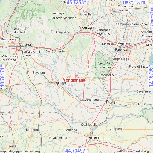
Montagnana GPS coordinates[2]
45° 13' 56.244" North, 11° 27' 53.388" East
| Map corner | latitude | longitude |
|---|---|---|
| Upper-left | 45.7253°, | 10.76171° |
| Center: | 45.23229°, | 11.46483° |
| Lower-right: | 44.73497°, | 12.16796° |
| Map W x H: | 110.1×110.1 km | = 68.4×68.4mi |
| max Lat: | 47.04031° ⇑34.3% North |
| Montagnana: | 45.23229° |
| min Lat: | ⇓65.7% South 35.50142° |
| min Long | Montagnana | max Long |
| 6.69888° | 11.46483° | 18.48682° |
| W 49%⇐ | ⇒51% E |
Elevation
Elevation of Montagnana is 17 m = 56 ft, and this is 289.7 m = 950 ft below average elevation for this country.
| Max E: |
2085 m = 6841 ft | 90.6% |
| Avg. | 306.7 m = 1006 ft | |
| Montagnana | 17 m = 56 ft | |
Min E: |
-4 m = -13 ft | 9.4% |
See also: Italy elevation on elevation.city.
Geographical zone
Montagnana is located in North temperate zone (between Tropic of Cancer and the Arctic Circle). Distance of this North polar circle is 2371.8 km =1473.8 mi to North.| Distance of | km | miles | from Montagnana |
|---|---|---|---|
| North Pole | 4977.7 | 3093 | to North |
| Arctic Circle | 2371.8 | 1473.8 | to North |
| Tropic Cancer | 2423.4 | 1505.8 | to South |
| Equator | 5029.4 | 3125.1 | to South |


Nearby cities:
15 places around Montagnana: (largest is in red/bold)
• Asigliano Veneto
8.2 km =5.1 mi,  349°
349°
• Bevilacqua
5.5 km =3.4 mi,  270°
270°
• Boschi Sant'Anna
8.7 km =5.4 mi,  259°
259°
• Casale di Scodosia
4.5 km =2.8 mi,  170°
170°
• Megliadino San Fidenzio
4.3 km =2.7 mi,  112°
112°
• Megliadino San Vitale
6.2 km =3.9 mi,  131°
131°
• Merlara
7.4 km =4.6 mi,  192°
192°
• Poiana Maggiore
7.1 km =4.4 mi,  24°
24°
• Pressana
7.2 km =4.5 mi,  321°
321°
• Roveredo di Guà
4.8 km =3 mi,  340°
340°
• Saletto
5.7 km =3.5 mi,  93°
93°
• San Fidenzio
4.5 km =2.8 mi, 113°
• Santa Margherita d'Adige
7.6 km =4.7 mi, 107°
• Terrazzo
8.6 km =5.3 mi,  219°
219°
• Urbana
4.7 km =2.9 mi,  199°
199°
Sources, notices
• [Note1] Compared only with cities in Italy existing in our database
• [Src1] Map data: © OpenStreetMap contributors (CC-BY-SA)
• [Src2] Other city data from geonames.org with taken over terms of usage.
• [Src3] Geographical zone / Annual Mean Temperature by Robert A. Rohde @ Wikipedia
