Monclassico geodata
Monclassico (Trentino-Alto Adige) is a seat of a third-order administrative division; located in Italy in Europe/Rome (GMT+2) time zone. With population of 812 people, there are 7589 cities with bigger population in this country. Compared to other cities in Italy, 97.2% of cities are located further ↓South; 58.7% of cities are located further →East and 91.5% of cities have lower elevation than Monclassico. Note1
Administrative division(s):
- Level 1: Trentino-Alto Adige
- Level 2: Provincia autonoma di Trento
- Level 3: Dimaro Folgarida


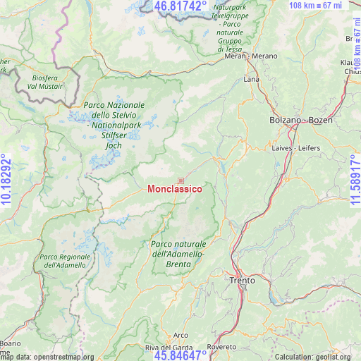
Monclassico GPS coordinates[2]
46° 20' 2.76" North, 10° 53' 9.744" East
| Map corner | latitude | longitude |
|---|---|---|
| Upper-left | 46.81742°, | 10.18292° |
| Center: | 46.3341°, | 10.88604° |
| Lower-right: | 45.84647°, | 11.58917° |
| Map W x H: | 108×108 km | = 67.1×67.1mi |
| max Lat: | 47.04031° ⇑2.8% North |
| Monclassico: | 46.3341° |
| min Lat: | ⇓97.2% South 35.50142° |
| min Long | Monclassico | max Long |
| 6.69888° | 10.88604° | 18.48682° |
| W 41.3%⇐ | ⇒58.7% E |
Elevation
Elevation of Monclassico is 757 m = 2484 ft, and this is 450.3 m = 1477 ft above average elevation for this country.
| Max E: |
2085 m = 6841 ft | 8.5% |
| Monclassico | 757 m 2484 ft | |
| Avg. | 306.7 m = 1006 ft | |
Min E: |
-4 m = -13 ft | 91.5% |
See also: Italy elevation on elevation.city.
Geographical zone
Monclassico is located in North temperate zone (between Tropic of Cancer and the Arctic Circle). Distance of this North polar circle is 2249.3 km =1397.6 mi to North.| Distance of | km | miles | from Monclassico |
|---|---|---|---|
| North Pole | 4855.2 | 3016.9 | to North |
| Arctic Circle | 2249.3 | 1397.6 | to North |
| Tropic Cancer | 2545.9 | 1581.9 | to South |
| Equator | 5151.9 | 3201.2 | to South |


Nearby cities:
15 places around Monclassico: (largest is in red/bold)
• Bresimo
10.7 km =6.6 mi,  36°
36°
• Caldes
5.5 km =3.4 mi,  48°
48°
• Cavizzana
6.6 km =4.1 mi,  56°
56°
• Commezzadura
3.8 km =2.4 mi,  248°
248°
• Croviana
1.8 km =1.1 mi, 47°
• Dimaro
1.3 km =0.8 mi,  226°
226°
• Dimaro-Folgarida
1.1 km =0.7 mi,  256°
256°
• Fontana Nuova-Bevia
10.7 km =6.6 mi, 36°
• Malè
3 km =1.9 mi, 43°
• Mezzana
6.9 km =4.3 mi, 253°
• Pellizzano
10.2 km =6.3 mi, 254°
• Rabbi Fonti
7.7 km =4.8 mi,  338°
338°
• San Bernardo
8.1 km =5 mi, 336°
• Terzolas
4.3 km =2.7 mi, 45°
• Tuenno
10.5 km =6.5 mi,  93°
93°
Sources, notices
• [Note1] Compared only with cities in Italy existing in our database
• [Src1] Map data: © OpenStreetMap contributors (CC-BY-SA)
• [Src2] Other city data from geonames.org with taken over terms of usage.
• [Src3] Geographical zone / Annual Mean Temperature by Robert A. Rohde @ Wikipedia
