Dimaro geodata
Dimaro (Trentino-Alto Adige) is a seat of a third-order administrative division; located in Italy in Europe/Rome (GMT+2) time zone. With population of 1,196 people, there are 5971 cities with bigger population in this country. Compared to other cities in Italy, 97.1% of cities are located further ↓South; 58.9% of cities are located further →East and 92.2% of cities have lower elevation than Dimaro. Note1
Administrative division(s):
- Level 1: Trentino-Alto Adige
- Level 2: Provincia autonoma di Trento
- Level 3: Dimaro Folgarida


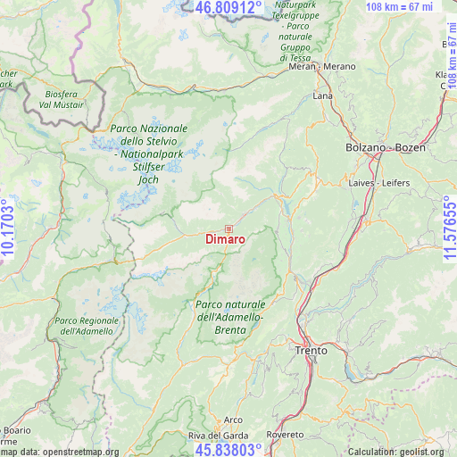
Dimaro GPS coordinates[2]
46° 19' 32.628" North, 10° 52' 24.312" East
| Map corner | latitude | longitude |
|---|---|---|
| Upper-left | 46.80912°, | 10.1703° |
| Center: | 46.32573°, | 10.87342° |
| Lower-right: | 45.83803°, | 11.57655° |
| Map W x H: | 108×108 km | = 67.1×67.1mi |
| max Lat: | 47.04031° ⇑2.9% North |
| Dimaro: | 46.32573° |
| min Lat: | ⇓97.1% South 35.50142° |
| min Long | Dimaro | max Long |
| 6.69888° | 10.87342° | 18.48682° |
| W 41.1%⇐ | ⇒58.9% E |
Elevation
Elevation of Dimaro is 777 m = 2549 ft, and this is 470.3 m = 1543 ft above average elevation for this country.
| Max E: |
2085 m = 6841 ft | 7.8% |
| Dimaro | 777 m 2549 ft | |
| Avg. | 306.7 m = 1006 ft | |
Min E: |
-4 m = -13 ft | 92.2% |
See also: Italy elevation on elevation.city.
Geographical zone
Dimaro is located in North temperate zone (between Tropic of Cancer and the Arctic Circle). Distance of this North polar circle is 2250.2 km =1398.2 mi to North.| Distance of | km | miles | from Dimaro |
|---|---|---|---|
| North Pole | 4856.1 | 3017.4 | to North |
| Arctic Circle | 2250.2 | 1398.2 | to North |
| Tropic Cancer | 2545 | 1581.4 | to South |
| Equator | 5150.9 | 3200.6 | to South |


Nearby cities:
15 places around Dimaro: (largest is in red/bold)
• Caldes
6.9 km =4.3 mi,  48°
48°
• Cavizzana
8 km =5 mi, 54°
• Commezzadura
2.6 km =1.6 mi,  260°
260°
• Croviana
3.1 km =1.9 mi, 47°
• Dimaro-Folgarida
0.7 km =0.4 mi,  350°
350°
• Malè
4.3 km =2.7 mi,  44°
44°
• Mezzana
5.7 km =3.5 mi, 259°
• Monclassico
1.3 km =0.8 mi, 46°
• Ossana
10.6 km =6.6 mi, 258°
• Pellizzano
9 km =5.6 mi, 258°
• Rabbi Fonti
8.3 km =5.2 mi, 347°
• San Bernardo
8.6 km =5.3 mi, 345°
• Terres
11.6 km =7.2 mi,  98°
98°
• Terzolas
5.6 km =3.5 mi, 45°
• Tuenno
11.5 km =7.1 mi,  88°
88°
Sources, notices
• [Note1] Compared only with cities in Italy existing in our database
• [Src1] Map data: © OpenStreetMap contributors (CC-BY-SA)
• [Src2] Other city data from geonames.org with taken over terms of usage.
• [Src3] Geographical zone / Annual Mean Temperature by Robert A. Rohde @ Wikipedia
