Gravedona-San Gregorio geodata
Gravedona-San Gregorio (Lombardy) is a seat of a third-order administrative division; located in Italy in Europe/Rome (GMT+2) time zone. With population of 3,697 people, there are 2559 cities with bigger population in this country. Compared to other cities in Italy, 94.9% of cities are located further ↓South; 76.3% of cities are located further →East and 50.2% of cities have higher elevation than Gravedona-San Gregorio. Note1
Administrative division(s):
- Level 1: Lombardy
- Level 2: Provincia di Como
- Level 3: Gravedona ed Uniti
Current local time in Gravedona-San Gregorio:
07:02 PM, WednesdayDifference from your time zone: hours


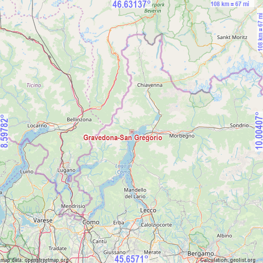
Gravedona-San Gregorio GPS coordinates[2]
46° 8' 47.004" North, 9° 18' 3.384" East
| Map corner | latitude | longitude |
|---|---|---|
| Upper-left | 46.63137°, | 8.59782° |
| Center: | 46.14639°, | 9.30094° |
| Lower-right: | 45.6571°, | 10.00407° |
| Map W x H: | 108.3×108.3 km | = 67.3×67.3mi |
| max Lat: | 47.04031° ⇑5.1% North |
| Gravedona-San Gregorio: | 46.14639° |
| min Lat: | ⇓94.9% South 35.50142° |
| min Long | Gravedona-San G | max Long |
| 6.69888° | 9.30094° | 18.48682° |
| W 23.7%⇐ | ⇒76.3% E |
Elevation
Elevation of Gravedona-San Gregorio is 234 m = 768 ft, and this is 72.7 m = 239 ft below average elevation for this country.
| Max E: |
2085 m = 6841 ft | 50.2% |
| Avg. | 306.7 m = 1006 ft | |
| Gravedona-San Gregorio | 234 m = 768 ft | |
Min E: |
-4 m = -13 ft | 49.8% |
See also: Italy elevation on elevation.city.
Geographical zone
Gravedona-San Gregorio is located in North temperate zone (between Tropic of Cancer and the Arctic Circle). Distance of this North polar circle is 2270.2 km =1410.6 mi to North.| Distance of | km | miles | from Gravedona-San Gregorio |
|---|---|---|---|
| North Pole | 4876.1 | 3029.9 | to North |
| Arctic Circle | 2270.2 | 1410.6 | to North |
| Tropic Cancer | 2525.1 | 1569 | to South |
| Equator | 5131 | 3188.3 | to South |


Nearby cities:
15 places around Gravedona-San Gregorio: (largest is in red/bold)
• Aurogna
5 km =3.1 mi,  56°
56°
• Calozzo
5.5 km =3.4 mi,  201°
201°
• Consiglio di Rumo
0.7 km =0.4 mi,  237°
237°
• Domaso
2.5 km =1.6 mi,  73°
73°
• Dongo
2.4 km =1.5 mi,  219°
219°
• Dorio
5.3 km =3.3 mi,  164°
164°
• Dosso del Liro
2.9 km =1.8 mi,  312°
312°
• Garzeno
4.2 km =2.6 mi,  250°
250°
• Livo
2.5 km =1.6 mi,  5°
5°
• Musso
4.3 km =2.7 mi,  209°
209°
• Peglio
1.6 km =1 mi,  342°
342°
• Pianello del Lario
5.2 km =3.2 mi, 200°
• Stazzona
2.2 km =1.4 mi, 246°
• Trezzone
4.8 km =3 mi,  54°
54°
• Vercana
3 km =1.9 mi, 61°
Sources, notices
• [Note1] Compared only with cities in Italy existing in our database
• [Src1] Map data: © OpenStreetMap contributors (CC-BY-SA)
• [Src2] Other city data from geonames.org with taken over terms of usage.
• [Src3] Geographical zone / Annual Mean Temperature by Robert A. Rohde @ Wikipedia
