Fregene geodata
Fregene (Latium) is a populated place; located in Italy in Europe/Rome (GMT+1) time zone. With population of 6,727 people, there are 1463 cities with bigger population in this country. Compared to other cities in Italy, 71.6% of cities are located further ↑North; 58.6% of cities are located further ←West and 97.8% of cities have higher elevation than Fregene. Note1
Administrative division(s):
- Level 1: Latium
- Level 2: Città metropolitana di Roma Capitale
- Level 3: Fiumicino


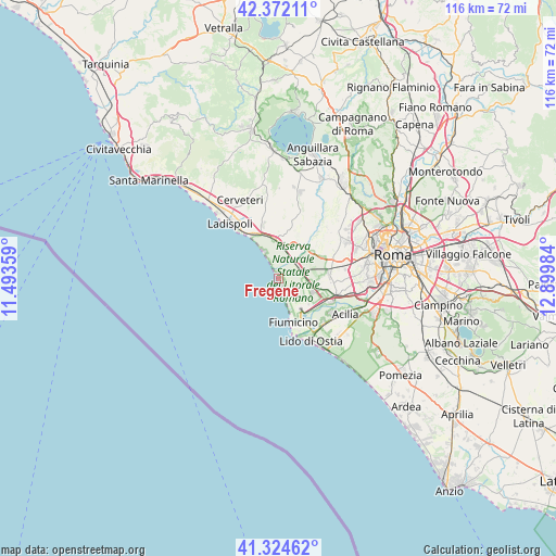
Fregene GPS coordinates[2]
41° 51' 1.836" North, 12° 11' 48.156" East
| Map corner | latitude | longitude |
|---|---|---|
| Upper-left | 42.37211°, | 11.49359° |
| Center: | 41.85051°, | 12.19671° |
| Lower-right: | 41.32462°, | 12.89984° |
| Map W x H: | 116.5×116.5 km | = 72.4×72.4mi |
| max Lat: | 47.04031° ⇑71.6% North |
| Fregene: | 41.85051° |
| min Lat: | ⇓28.4% South 35.50142° |
| min Long | Fregene | max Long |
| 6.69888° | 12.19671° | 18.48682° |
| W 58.6%⇐ | ⇒41.4% E |
Elevation
Elevation of Fregene is 4 m = 13 ft, and this is 302.7 m = 993 ft below average elevation for this country.
| Max E: |
2085 m = 6841 ft | 97.8% |
| Avg. | 306.7 m = 1006 ft | |
| Fregene | 4 m = 13 ft | |
Min E: |
-4 m = -13 ft | 2.2% |
See also: Italy elevation on elevation.city.
Geographical zone
Fregene is located in North temperate zone (between Tropic of Cancer and the Arctic Circle). Distance of this Northern Tropic circle is 2047.4 km =1272.2 mi to South.| Distance of | km | miles | from Fregene |
|---|---|---|---|
| North Pole | 5353.7 | 3326.6 | to North |
| Arctic Circle | 2747.8 | 1707.4 | to North |
| Tropic Cancer | 2047.4 | 1272.2 | to South |
| Equator | 4653.3 | 2891.4 | to South |


Nearby cities:
15 places around Fregene: (largest is in red/bold)
• Acilia-Castel Fusano-Ostia Antica
14.7 km =9.1 mi,  131°
131°
• Ara Nova
9.8 km =6.1 mi,  21°
21°
• Centro Tre Denari
7.3 km =4.5 mi,  1°
1°
• Fiumicino-Isola Sacra
9.4 km =5.8 mi,  159°
159°
• Focene
4.3 km =2.7 mi, 161°
• La Massimina-Casal Lumbroso
13.5 km =8.4 mi,  79°
79°
• Maccarese
3.5 km =2.2 mi,  32°
32°
• Maccarese-Stazione
4.6 km =2.9 mi,  49°
49°
• Marina San Nicola
11 km =6.8 mi,  324°
324°
• Palidoro
8.9 km =5.5 mi,  350°
350°
• Parco Leonardo
10.2 km =6.3 mi,  123°
123°
• Passoscuro
6.6 km =4.1 mi,  330°
330°
• Ponte Galeria-La Pisana
11.8 km =7.3 mi,  92°
92°
• Valcanneto
11.6 km =7.2 mi,  343°
343°
• Valle Santa
14.7 km =9.1 mi,  43°
43°
Sources, notices
• [Note1] Compared only with cities in Italy existing in our database
• [Src1] Map data: © OpenStreetMap contributors (CC-BY-SA)
• [Src2] Other city data from geonames.org with taken over terms of usage.
• [Src3] Geographical zone / Annual Mean Temperature by Robert A. Rohde @ Wikipedia
