Ara Nova geodata
Ara Nova (Latium) is a populated place; located in Italy in Europe/Rome (GMT+1) time zone. With population of 6,158 people, there are 1596 cities with bigger population in this country. Compared to other cities in Italy, 71% of cities are located further ↑North; 59.2% of cities are located further ←West and 75.2% of cities have higher elevation than Ara Nova. Note1
Administrative division(s):
- Level 1: Latium
- Level 2: Città metropolitana di Roma Capitale
- Level 3: Fiumicino


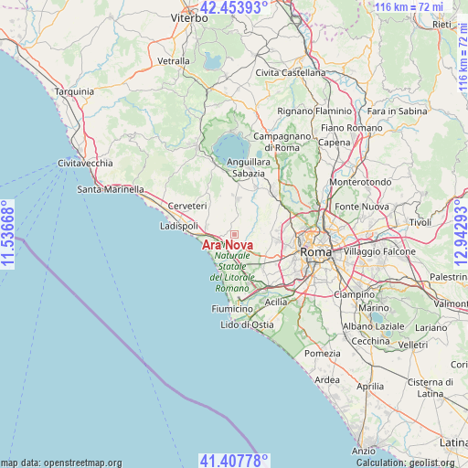
Ara Nova GPS coordinates[2]
41° 55' 58.8" North, 12° 14' 23.28" East
| Map corner | latitude | longitude |
|---|---|---|
| Upper-left | 42.45393°, | 11.53668° |
| Center: | 41.933°, | 12.2398° |
| Lower-right: | 41.40778°, | 12.94293° |
| Map W x H: | 116.3×116.3 km | = 72.3×72.3mi |
| max Lat: | 47.04031° ⇑71% North |
| Ara Nova: | 41.933° |
| min Lat: | ⇓29% South 35.50142° |
| min Long | Ara Nova | max Long |
| 6.69888° | 12.2398° | 18.48682° |
| W 59.2%⇐ | ⇒40.8% E |
Elevation
Elevation of Ara Nova is 73 m = 240 ft, and this is 233.7 m = 767 ft below average elevation for this country.
| Max E: |
2085 m = 6841 ft | 75.2% |
| Avg. | 306.7 m = 1006 ft | |
| Ara Nova | 73 m = 240 ft | |
Min E: |
-4 m = -13 ft | 24.8% |
See also: Italy elevation on elevation.city.
Geographical zone
Ara Nova is located in North temperate zone (between Tropic of Cancer and the Arctic Circle). Distance of this Northern Tropic circle is 2056.6 km =1277.9 mi to South.| Distance of | km | miles | from Ara Nova |
|---|---|---|---|
| North Pole | 5344.5 | 3320.9 | to North |
| Arctic Circle | 2738.7 | 1701.7 | to North |
| Tropic Cancer | 2056.6 | 1277.9 | to South |
| Equator | 4662.5 | 2897.1 | to South |


Nearby cities:
15 places around Ara Nova: (largest is in red/bold)
• Centro Tre Denari
3.8 km =2.4 mi,  240°
240°
• Focene
13.4 km =8.3 mi,  189°
189°
• Fregene
9.8 km =6.1 mi,  201°
201°
• La Massimina-Casal Lumbroso
11.7 km =7.3 mi,  124°
124°
• Maccarese
6.4 km =4 mi, 194°
• Maccarese-Stazione
6.2 km =3.9 mi,  180°
180°
• Marina San Nicola
9.9 km =6.2 mi,  268°
268°
• Osteria Nuova
12.9 km =8 mi,  26°
26°
• Palidoro
5.1 km =3.2 mi, 265°
• Passoscuro
7.6 km =4.7 mi, 243°
• Ponte Galeria-La Pisana
12.7 km =7.9 mi,  139°
139°
• Ponton dell'Elce
10 km =6.2 mi,  357°
357°
• Tragliatella Campitello
9 km =5.6 mi,  6°
6°
• Valcanneto
7.1 km =4.4 mi,  286°
286°
• Valle Santa
6.7 km =4.2 mi,  78°
78°
Sources, notices
• [Note1] Compared only with cities in Italy existing in our database
• [Src1] Map data: © OpenStreetMap contributors (CC-BY-SA)
• [Src2] Other city data from geonames.org with taken over terms of usage.
• [Src3] Geographical zone / Annual Mean Temperature by Robert A. Rohde @ Wikipedia
