Forio geodata
Forio (Campania) is a seat of a third-order administrative division; located in Italy in Europe/Rome (GMT+2) time zone. With population of 15,969 people, there are 569 cities with bigger population in this country. Compared to other cities in Italy, 82.1% of cities are located further ↑North; 77.1% of cities are located further ←West and 93% of cities have higher elevation than Forio. Note1


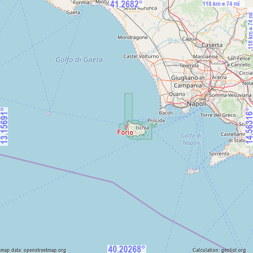
Forio GPS coordinates[2]
40° 44' 15.252" North, 13° 51' 36.108" East
| Map corner | latitude | longitude |
|---|---|---|
| Upper-left | 41.2682°, | 13.15691° |
| Center: | 40.73757°, | 13.86003° |
| Lower-right: | 40.20268°, | 14.56316° |
| Map W x H: | 118.5×118.5 km | = 73.6×73.6mi |
| max Lat: | 47.04031° ⇑82.1% North |
| Forio: | 40.73757° |
| min Lat: | ⇓17.9% South 35.50142° |
| min Long | Forio | max Long |
| 6.69888° | 13.86003° | 18.48682° |
| W 77.1%⇐ | ⇒22.9% E |
Elevation
Elevation of Forio is 12 m = 39 ft, and this is 294.7 m = 967 ft below average elevation for this country.
| Max E: |
2085 m = 6841 ft | 93% |
| Avg. | 306.7 m = 1006 ft | |
| Forio | 12 m = 39 ft | |
Min E: |
-4 m = -13 ft | 7% |
See also: Italy elevation on elevation.city.
Geographical zone
Forio is located in North temperate zone (between Tropic of Cancer and the Arctic Circle). Distance of this Northern Tropic circle is 1923.7 km =1195.3 mi to South.| Distance of | km | miles | from Forio |
|---|---|---|---|
| North Pole | 5477.5 | 3403.6 | to North |
| Arctic Circle | 2871.6 | 1784.3 | to North |
| Tropic Cancer | 1923.7 | 1195.3 | to South |
| Equator | 4529.6 | 2814.6 | to South |


Nearby cities:
15 places around Forio: (largest is in red/bold)
• Bacoli
19.1 km =11.9 mi,  69°
69°
• Barano d'Ischia
6.1 km =3.8 mi,  114°
114°
• Casamicciola Terme
4.5 km =2.8 mi,  77°
77°
• Country Park
24.4 km =15.2 mi,  48°
48°
• Festinese
25.6 km =15.9 mi, 47°
• Ischia
7.5 km =4.7 mi,  89°
89°
• Ischia Porto
7.7 km =4.8 mi, 88°
• Lacco Ameno
2.6 km =1.6 mi,  60°
60°
• Masseria Vecchia Ovest
24.2 km =15 mi, 45°
• Monte di Procida
17.4 km =10.8 mi, 67°
• Monterusciello
23.8 km =14.8 mi, 52°
• Pozzuoli
23.1 km =14.4 mi, 59°
• Procida
13.2 km =8.2 mi, 80°
• Sant'Angelo
5.2 km =3.2 mi,  147°
147°
• Serrara Fontana
3.9 km =2.4 mi,  129°
129°
Sources, notices
• [Note1] Compared only with cities in Italy existing in our database
• [Src1] Map data: © OpenStreetMap contributors (CC-BY-SA)
• [Src2] Other city data from geonames.org with taken over terms of usage.
• [Src3] Geographical zone / Annual Mean Temperature by Robert A. Rohde @ Wikipedia
