Crugnola geodata
Crugnola (Lombardy) is a populated place; located in Italy in Europe/Rome (GMT+2) time zone. With population of 2,069 people, there are 4035 cities with bigger population in this country. Compared to other cities in Italy, 82.6% of cities are located further ↓South; 84.9% of cities are located further →East and 57.1% of cities have lower elevation than Crugnola. Note1


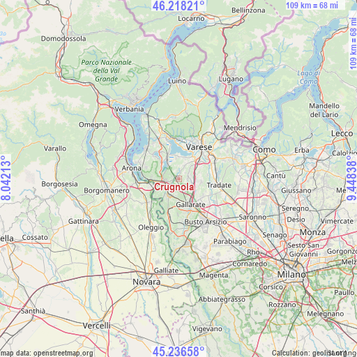
Crugnola GPS coordinates[2]
45° 43' 46.38" North, 8° 44' 42.9" East
| Map corner | latitude | longitude |
|---|---|---|
| Upper-left | 46.21821°, | 8.04213° |
| Center: | 45.72955°, | 8.74525° |
| Lower-right: | 45.23658°, | 9.44838° |
| Map W x H: | 109.1×109.1 km | = 67.8×67.8mi |
| max Lat: | 47.04031° ⇑17.4% North |
| Crugnola: | 45.72955° |
| min Lat: | ⇓82.6% South 35.50142° |
| min Long | Crugnola | max Long |
| 6.69888° | 8.74525° | 18.48682° |
| W 15.1%⇐ | ⇒84.9% E |
Elevation
Elevation of Crugnola is 279 m = 915 ft, and this is 27.7 m = 91 ft below average elevation for this country.
| Max E: |
2085 m = 6841 ft | 42.9% |
| Avg. | 306.7 m = 1006 ft | |
| Crugnola | 279 m = 915 ft | |
Min E: |
-4 m = -13 ft | 57.1% |
See also: Italy elevation on elevation.city.
Geographical zone
Crugnola is located in North temperate zone (between Tropic of Cancer and the Arctic Circle). Distance of this North polar circle is 2316.5 km =1439.4 mi to North.| Distance of | km | miles | from Crugnola |
|---|---|---|---|
| North Pole | 4922.4 | 3058.6 | to North |
| Arctic Circle | 2316.5 | 1439.4 | to North |
| Tropic Cancer | 2478.7 | 1540.2 | to South |
| Equator | 5084.6 | 3159.4 | to South |


Nearby cities:
15 places around Crugnola: (largest is in red/bold)
• Albizzate
4.5 km =2.8 mi,  93°
93°
• Arsago Seprio
4.7 km =2.9 mi,  189°
189°
• Besnate
3.8 km =2.4 mi,  153°
153°
• Brunello
5.5 km =3.4 mi,  44°
44°
• Casale Litta
4.3 km =2.7 mi,  355°
355°
• Cimbro
2 km =1.2 mi,  289°
289°
• Corgeno
4.8 km =3 mi, 292°
• Crosio della Valle
3.9 km =2.4 mi,  30°
30°
• Jerago Con Orago
4.8 km =3 mi,  125°
125°
• Montonate
2.9 km =1.8 mi,  47°
47°
• Mornago
1.8 km =1.1 mi,  13°
13°
• Solbiate Arno
5.4 km =3.4 mi,  101°
101°
• Sumirago
3.1 km =1.9 mi,  75°
75°
• Vergiate
4 km =2.5 mi,  257°
257°
• Villadosia
2.6 km =1.6 mi,  328°
328°
Sources, notices
• [Note1] Compared only with cities in Italy existing in our database
• [Src1] Map data: © OpenStreetMap contributors (CC-BY-SA)
• [Src2] Other city data from geonames.org with taken over terms of usage.
• [Src3] Geographical zone / Annual Mean Temperature by Robert A. Rohde @ Wikipedia
