Comeglians geodata
Comeglians (Friuli Venezia Giulia) is a seat of a third-order administrative division; located in Italy in Europe/Rome (GMT+2) time zone. With population of 206 people, there are 11107 cities with bigger population in this country. Compared to other cities in Italy, 98.4% of cities are located further ↓South; 66.8% of cities are located further ←West and 81.1% of cities have lower elevation than Comeglians. Note1
Administrative division(s):
- Level 1: Friuli Venezia Giulia
- Level 2: Provincia di Udine
- Level 3: Comeglians


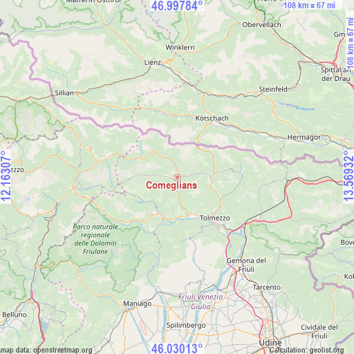
Comeglians GPS coordinates[2]
46° 30' 58.104" North, 12° 51' 58.284" East
| Map corner | latitude | longitude |
|---|---|---|
| Upper-left | 46.99784°, | 12.16307° |
| Center: | 46.51614°, | 12.86619° |
| Lower-right: | 46.03013°, | 13.56932° |
| Map W x H: | 107.6×107.6 km | = 66.9×66.9mi |
| max Lat: | 47.04031° ⇑1.6% North |
| Comeglians: | 46.51614° |
| min Lat: | ⇓98.4% South 35.50142° |
| min Long | Comeglians | max Long |
| 6.69888° | 12.86619° | 18.48682° |
| W 66.8%⇐ | ⇒33.2% E |
Elevation
Elevation of Comeglians is 540 m = 1772 ft, and this is 233.3 m = 765 ft above average elevation for this country.
| Max E: |
2085 m = 6841 ft | 18.9% |
| Comeglians | 540 m 1772 ft | |
| Avg. | 306.7 m = 1006 ft | |
Min E: |
-4 m = -13 ft | 81.1% |
See also: Italy elevation on elevation.city.
Geographical zone
Comeglians is located in North temperate zone (between Tropic of Cancer and the Arctic Circle). Distance of this North polar circle is 2229.1 km =1385.1 mi to North.| Distance of | km | miles | from Comeglians |
|---|---|---|---|
| North Pole | 4835 | 3004.3 | to North |
| Arctic Circle | 2229.1 | 1385.1 | to North |
| Tropic Cancer | 2566.2 | 1594.6 | to South |
| Equator | 5172.1 | 3213.8 | to South |


Nearby cities:
15 places around Comeglians: (largest is in red/bold)
• Ampezzo
12.5 km =7.8 mi,  205°
205°
• Arta Terme
12.5 km =7.8 mi,  108°
108°
• Cercivento
9.7 km =6 mi,  82°
82°
• Enemonzo-Quinis
12 km =7.5 mi,  175°
175°
• Forni Avoltri
10.4 km =6.5 mi,  318°
318°
• Lauco
11.4 km =7.1 mi,  153°
153°
• Ovaro
3.6 km =2.2 mi, 178°
• Paluzza
11.6 km =7.2 mi, 81°
• Pieria-Prato Carnico
4.8 km =3 mi,  275°
275°
• Prato Carnico
4.4 km =2.7 mi, 276°
• Ravascletto
4.3 km =2.7 mi, 76°
• Raveo
9.2 km =5.7 mi, 177°
• Rigolato
4.5 km =2.8 mi,  339°
339°
• Sutrio
9.7 km =6 mi,  92°
92°
• Villa Santina
12.2 km =7.6 mi,  158°
158°
Sources, notices
• [Note1] Compared only with cities in Italy existing in our database
• [Src1] Map data: © OpenStreetMap contributors (CC-BY-SA)
• [Src2] Other city data from geonames.org with taken over terms of usage.
• [Src3] Geographical zone / Annual Mean Temperature by Robert A. Rohde @ Wikipedia
