Cassacco geodata
Cassacco (Friuli Venezia Giulia) is a seat of a third-order administrative division; located in Italy in Europe/Rome (GMT+2) time zone. With population of 2,819 people, there are 3195 cities with bigger population in this country. Compared to other cities in Italy, 95.6% of cities are located further ↓South; 70.3% of cities are located further ←West and 56.4% of cities have higher elevation than Cassacco. Note1
Administrative division(s):
- Level 1: Friuli Venezia Giulia
- Level 2: Provincia di Udine
- Level 3: Cassacco


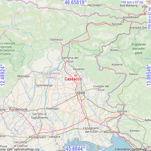
Cassacco GPS coordinates[2]
46° 10' 24.42" North, 13° 11' 32.496" East
| Map corner | latitude | longitude |
|---|---|---|
| Upper-left | 46.65819°, | 12.48924° |
| Center: | 46.17345°, | 13.19236° |
| Lower-right: | 45.6844°, | 13.89549° |
| Map W x H: | 108.3×108.3 km | = 67.3×67.3mi |
| max Lat: | 47.04031° ⇑4.4% North |
| Cassacco: | 46.17345° |
| min Lat: | ⇓95.6% South 35.50142° |
| min Long | Cassacco | max Long |
| 6.69888° | 13.19236° | 18.48682° |
| W 70.3%⇐ | ⇒29.7% E |
Elevation
Elevation of Cassacco is 192 m = 630 ft, and this is 114.7 m = 376 ft below average elevation for this country.
| Max E: |
2085 m = 6841 ft | 56.4% |
| Avg. | 306.7 m = 1006 ft | |
| Cassacco | 192 m = 630 ft | |
Min E: |
-4 m = -13 ft | 43.6% |
See also: Italy elevation on elevation.city.
Geographical zone
Cassacco is located in North temperate zone (between Tropic of Cancer and the Arctic Circle). Distance of this North polar circle is 2267.2 km =1408.8 mi to North.| Distance of | km | miles | from Cassacco |
|---|---|---|---|
| North Pole | 4873.1 | 3028 | to North |
| Arctic Circle | 2267.2 | 1408.8 | to North |
| Tropic Cancer | 2528.1 | 1570.9 | to South |
| Equator | 5134 | 3190.1 | to South |


Nearby cities:
15 places around Cassacco: (largest is in red/bold)
• Brazzacco
6.3 km =3.9 mi,  203°
203°
• Bueriis
4.5 km =2.8 mi,  346°
346°
• Colloredo di Monte Albano
4.3 km =2.7 mi,  256°
256°
• Colloredo di Monte Albano-Lauzzana
5.6 km =3.5 mi,  252°
252°
• Magnano in Riviera
5.6 km =3.5 mi,  1°
1°
• Mels
6.4 km =4 mi,  272°
272°
• Qualso
3.9 km =2.4 mi,  85°
85°
• Reana del Roiale
4.7 km =2.9 mi,  149°
149°
• Reana del Rojale
5.4 km =3.4 mi,  128°
128°
• Santo Stefano
6.4 km =4 mi,  307°
307°
• Savorgnano del Torre
6.2 km =3.9 mi,  98°
98°
• Tarcento
4.7 km =2.9 mi,  21°
21°
• Treppo Grande
4.2 km =2.6 mi, 314°
• Tricesimo
2.3 km =1.4 mi, 128°
• Vendoglio-Carvacco
3.1 km =1.9 mi,  281°
281°
Sources, notices
• [Note1] Compared only with cities in Italy existing in our database
• [Src1] Map data: © OpenStreetMap contributors (CC-BY-SA)
• [Src2] Other city data from geonames.org with taken over terms of usage.
• [Src3] Geographical zone / Annual Mean Temperature by Robert A. Rohde @ Wikipedia
