Caltignaga geodata
Caltignaga (Piedmont) is a seat of a third-order administrative division; located in Italy in Europe/Rome (GMT+2) time zone. With population of 1,743 people, there are 4585 cities with bigger population in this country. Compared to other cities in Italy, 74.3% of cities are located further ↓South; 86.9% of cities are located further →East and 57.8% of cities have higher elevation than Caltignaga. Note1


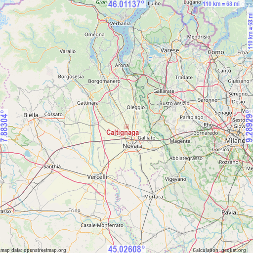
Caltignaga GPS coordinates[2]
45° 31' 15.168" North, 8° 35' 10.176" East
| Map corner | latitude | longitude |
|---|---|---|
| Upper-left | 46.01137°, | 7.88304° |
| Center: | 45.52088°, | 8.58616° |
| Lower-right: | 45.02608°, | 9.28929° |
| Map W x H: | 109.6×109.6 km | = 68.1×68.1mi |
| max Lat: | 47.04031° ⇑25.7% North |
| Caltignaga: | 45.52088° |
| min Lat: | ⇓74.3% South 35.50142° |
| min Long | Caltignaga | max Long |
| 6.69888° | 8.58616° | 18.48682° |
| W 13.1%⇐ | ⇒86.9% E |
Elevation
Elevation of Caltignaga is 181 m = 594 ft, and this is 125.7 m = 412 ft below average elevation for this country.
| Max E: |
2085 m = 6841 ft | 57.8% |
| Avg. | 306.7 m = 1006 ft | |
| Caltignaga | 181 m = 594 ft | |
Min E: |
-4 m = -13 ft | 42.2% |
See also: Italy elevation on elevation.city.
Geographical zone
Caltignaga is located in North temperate zone (between Tropic of Cancer and the Arctic Circle). Distance of this North polar circle is 2339.7 km =1453.8 mi to North.| Distance of | km | miles | from Caltignaga |
|---|---|---|---|
| North Pole | 4945.6 | 3073.1 | to North |
| Arctic Circle | 2339.7 | 1453.8 | to North |
| Tropic Cancer | 2455.5 | 1525.8 | to South |
| Equator | 5061.4 | 3145 | to South |


Nearby cities:
15 places around Caltignaga: (largest is in red/bold)
• Barengo
8.3 km =5.2 mi,  317°
317°
• Bellinzago Novarese
6.9 km =4.3 mi,  39°
39°
• Briona
8.6 km =5.3 mi,  286°
286°
• Cameri
6.3 km =3.9 mi,  109°
109°
• Casaleggio Novara
8.1 km =5 mi,  243°
243°
• Castellazzo Novarese
7.8 km =4.8 mi,  263°
263°
• Fornaci
8.4 km =5.2 mi,  11°
11°
• Galliate
9.9 km =6.2 mi,  117°
117°
• Momo
6.4 km =4 mi,  337°
337°
• Nibbia
4.4 km =2.7 mi,  211°
211°
• Novara
8.7 km =5.4 mi,  161°
161°
• Oleggio
9.5 km =5.9 mi,  27°
27°
• San Pietro Mosezzo
8.1 km =5 mi,  203°
203°
• Sologno
2.1 km =1.3 mi,  330°
330°
• Vaprio D'Agogna
9.5 km =5.9 mi, 344°
Sources, notices
• [Note1] Compared only with cities in Italy existing in our database
• [Src1] Map data: © OpenStreetMap contributors (CC-BY-SA)
• [Src2] Other city data from geonames.org with taken over terms of usage.
• [Src3] Geographical zone / Annual Mean Temperature by Robert A. Rohde @ Wikipedia
