Bressanvido geodata
Bressanvido (Veneto) is a seat of a third-order administrative division; located in Italy in Europe/Rome (GMT+2) time zone. With population of 1,201 people, there are 5953 cities with bigger population in this country. Compared to other cities in Italy, 78.9% of cities are located further ↓South; 51% of cities are located further ←West and 79.6% of cities have higher elevation than Bressanvido. Note1


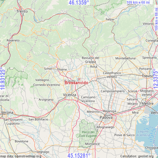
Bressanvido GPS coordinates[2]
45° 38' 47.436" North, 11° 38' 3.732" East
| Map corner | latitude | longitude |
|---|---|---|
| Upper-left | 46.1359°, | 10.93125° |
| Center: | 45.64651°, | 11.63437° |
| Lower-right: | 45.15281°, | 12.3375° |
| Map W x H: | 109.3×109.3 km | = 67.9×67.9mi |
| max Lat: | 47.04031° ⇑21.1% North |
| Bressanvido: | 45.64651° |
| min Lat: | ⇓78.9% South 35.50142° |
| min Long | Bressanvido | max Long |
| 6.69888° | 11.63437° | 18.48682° |
| W 51%⇐ | ⇒49% E |
Elevation
Elevation of Bressanvido is 52 m = 171 ft, and this is 254.7 m = 836 ft below average elevation for this country.
| Max E: |
2085 m = 6841 ft | 79.6% |
| Avg. | 306.7 m = 1006 ft | |
| Bressanvido | 52 m = 171 ft | |
Min E: |
-4 m = -13 ft | 20.4% |
See also: Italy elevation on elevation.city.
Geographical zone
Bressanvido is located in North temperate zone (between Tropic of Cancer and the Arctic Circle). Distance of this North polar circle is 2325.8 km =1445.2 mi to North.| Distance of | km | miles | from Bressanvido |
|---|---|---|---|
| North Pole | 4931.6 | 3064.4 | to North |
| Arctic Circle | 2325.8 | 1445.2 | to North |
| Tropic Cancer | 2469.5 | 1534.5 | to South |
| Equator | 5075.4 | 3153.7 | to South |


Nearby cities:
15 places around Bressanvido: (largest is in red/bold)
• Ancignano
1.7 km =1.1 mi,  349°
349°
• Bolzano Vicentino
5 km =3.1 mi,  191°
191°
• Camazzole
5 km =3.1 mi,  89°
89°
• Carmignano di Brenta
6 km =3.7 mi,  112°
112°
• Dueville
6.6 km =4.1 mi,  259°
259°
• Friola
4.9 km =3 mi,  44°
44°
• Longa
3.8 km =2.4 mi,  9°
9°
• Maragnole
5 km =3.1 mi,  332°
332°
• Montecchio Precalcino
5.9 km =3.7 mi,  291°
291°
• Poianella
1.8 km =1.1 mi, 194°
• Pozzoleone
2.9 km =1.8 mi,  83°
83°
• San Pietro in Gu
5.2 km =3.2 mi,  144°
144°
• Sandrigo
3.9 km =2.4 mi, 294°
• Schiavon
5.6 km =3.5 mi, 9°
• Vigardolo
5.7 km =3.5 mi,  218°
218°
Sources, notices
• [Note1] Compared only with cities in Italy existing in our database
• [Src1] Map data: © OpenStreetMap contributors (CC-BY-SA)
• [Src2] Other city data from geonames.org with taken over terms of usage.
• [Src3] Geographical zone / Annual Mean Temperature by Robert A. Rohde @ Wikipedia
