Bellona geodata
Bellona (Campania) is a seat of a third-order administrative division; located in Italy in Europe/Rome (GMT+2) time zone. With population of 4,727 people, there are 2059 cities with bigger population in this country. Compared to other cities in Italy, 77.2% of cities are located further ↑North; 80.2% of cities are located further ←West and 75.6% of cities have higher elevation than Bellona. Note1


Bellona GPS coordinates[2]
41° 9' 37.872" North, 14° 13' 59.268" East
| Map corner | latitude | longitude |
|---|---|---|
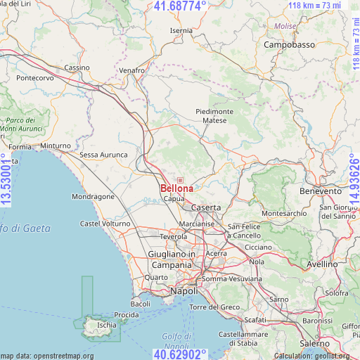
| Upper-left | 41.68774°, | 13.53001° |
| Center: | 41.16052°, | 14.23313° |
| Lower-right: | 40.62902°, | 14.93626° |
| Map W x H: | 117.7×117.7 km | = 73.1×73.1mi |
| max Lat: | 47.04031° ⇑77.2% North |
| Bellona: | 41.16052° |
| min Lat: | ⇓22.8% South 35.50142° |
| min Long | Bellona | max Long |
| 6.69888° | 14.23313° | 18.48682° |
| W 80.2%⇐ | ⇒19.8% E |
Elevation
Elevation of Bellona is 71 m = 233 ft, and this is 235.7 m = 773 ft below average elevation for this country.
| Max E: |
2085 m = 6841 ft | 75.6% |
| Avg. | 306.7 m = 1006 ft | |
| Bellona | 71 m = 233 ft | |
Min E: |
-4 m = -13 ft | 24.4% |
See also: Italy elevation on elevation.city.
Geographical zone
Bellona is located in North temperate zone (between Tropic of Cancer and the Arctic Circle). Distance of this Northern Tropic circle is 1970.7 km =1224.5 mi to South.| Distance of | km | miles | from Bellona |
|---|---|---|---|
| North Pole | 5430.4 | 3374.3 | to North |
| Arctic Circle | 2824.6 | 1755.1 | to North |
| Tropic Cancer | 1970.7 | 1224.5 | to South |
| Equator | 4576.6 | 2843.8 | to South |


Nearby cities:
15 places around Bellona: (largest is in red/bold)
• Camigliano
3 km =1.9 mi,  319°
319°
• Capua
6.4 km =4 mi,  195°
195°
• Castel di Sasso
5.1 km =3.2 mi,  46°
46°
• Formicola
5.6 km =3.5 mi,  1°
1°
• Giano Vetusto
5.7 km =3.5 mi, 324°
• Liberi
8.7 km =5.4 mi,  32°
32°
• Pastorano
3.7 km =2.3 mi,  307°
307°
• Piana di Monte Verna
8.5 km =5.3 mi,  85°
85°
• Pignataro Maggiore
6.2 km =3.9 mi,  301°
301°
• Pontelatone
4 km =2.5 mi,  18°
18°
• Pozzillo
5.7 km =3.5 mi,  326°
326°
• San Prisco
9.1 km =5.7 mi,  156°
156°
• Sant'Angelo in Formis
5.1 km =3.2 mi, 163°
• Santa Maria Capua Vetere
8.9 km =5.5 mi,  169°
169°
• Vitulazio
1.7 km =1.1 mi,  279°
279°
Sources, notices
• [Note1] Compared only with cities in Italy existing in our database
• [Src1] Map data: © OpenStreetMap contributors (CC-BY-SA)
• [Src2] Other city data from geonames.org with taken over terms of usage.
• [Src3] Geographical zone / Annual Mean Temperature by Robert A. Rohde @ Wikipedia
